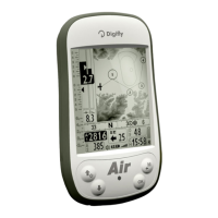
AIR_Manual_506a_ENG_rev_1.pdf Page 77/96
Digi-FLYBOX TELEMETRY DATA TYPE SELECTION
Select the telemetry data type with the
ADVANCED SETUP \ n. 25 TELE
parameter:
TELE=OFF: no data transmitted (default).
TELE=CAR: GPS($GPGGA + $GPRMC) sent once per second
TELE=FL1: GPS($GPGGA + $GPRMC) sent once per second and $PDGFTL1 sent once per second.
TELE=FL2: GPS($GPGGA + $GPRMC) sent once per second and $PDGFTL1 sent 10 times per second.
TELE=FL3: LK8EX1 sent 10 times per second.
TELE=FL4 and FL5: (reserved for future implementations).
TELE=FL6: barometer in thousandths of mb in 6 digit hex “xxxxxx[CR][LF]” sent 10 times per second.
TELE=FL7: barometer in hundreds of mb in 5 digit hex “PSR[SP]xxxxx[CR][LF]” sent 10 times per second
DATA COMMUNICATION SETTINGS:
, no parity, 8 data bit, 1 stop bit
The Nmea field “checksum” is composed by "*" and 2 hex digits representing the "exclusive OR”
$GPRMC,112426.000,A,4429.6564,N,01120.8056,E,0.62,15.74,271218,,,A*53<CR><LF>
A=data valid or V=data not valid
Magnetic Variation degrees
E=east or W=west (not used)
Mode indicator A
N=data not valid, A=Autonomous, D=Differential,
E=Estimated
End of message termination
$GPGGA,112426.000,4429.6564,N,01120.8056,E,1,6,1.37,58.9,M,47.6,M,,*6F<CR><LF>
0=fix not available, 1=GPS fix, 2=Differential GPS fix
Number of satellites used in position fix
Horizontal Dilution of Precision
mean-sea-level Altitude (geoid)
Geoidal Separation 47.6 meters
Difference between the WGS-84 reference ellipsoid
surface and the mean-sea-level altitude (geoid)
Units of Geoidal Separation
Age of Differential Correction
Null field when DGPS is not used
Differential Ref. Station ID
Null field when DGPS is not used
End of message termination