DJI Dock 2/Matrice 3D Series Unmanned Aircraft Flight Manual
©
2024 DJI All Rights Reserved.
41
• Users can click the user account in the upper right corner, select User Center to view
the account and organization information, and add a mobile number or email address
for a service subscription. After the service is subscribed, the system will automatically
send a message or email to notify users of an emergency or failed task.
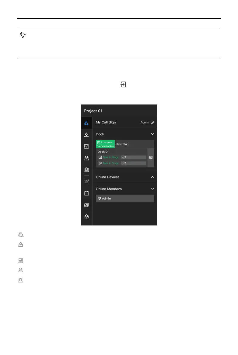
Project Details
In the Projects page, select a project and click to enter the project. Users can plan flight
routes, create task plans, manage models, and media les, as well as monitor real-time ight
task information.
Team: Displays team, device, and ight task information of the project.
Map Annotations: Users can create and manage annotations (e.g. cell sites and other
buildings) on the map.
Map Photos: Users can manage all the photos that are overlaid on the map.
Map Models: Users can view and manage the 2D and 3D models.
Map Task Area: The aircraft will plan the optimal path according to the task area data to
perform FlyTo tasks and RTH, while bypassing obstacles and GEO zones.
a. Custom Flight Area: Users can manage custom task areas (user defined operation
zones) and custom GEO Zones (user dened no-y zones).
b. Obstacle Data: Users can enable obstacle data, and DJI FlightHub 2 will distribute the
data to the dock aircraft.
c. Data Synchronization: When the ight areas are updated, the data will be automatically
synchronized to the idle dock and aircraft.
 Loading...