153
Search
SEARCH
T
here are many ways to search the area for ports, tide stations, and current stations. You can also search for information based on
t
he cursor position. The search options and the search area distance are determined by the installed map card and selected map
s
ource.
Search by Nearest Port, Tide Station, or Current Station
The control head must have a separate purchase map card installed to enable the features in this section.
1. Press the CHECK/INFO key.
2. Select Nearest Port, Nearest Tide Station, or Nearest Current Station.
3. Press the RIGHT Cursor key.
Search by Cursor Position
1. Use the Cursor Control key to move the cursor to a waypoint or position on the chart.
2. Press the CHECK/INFO key.
Search for Contour Depth
1. Use the Cursor Control key to move the cursor to a contour on the chart.
2. Press the CHECK/INFO key.
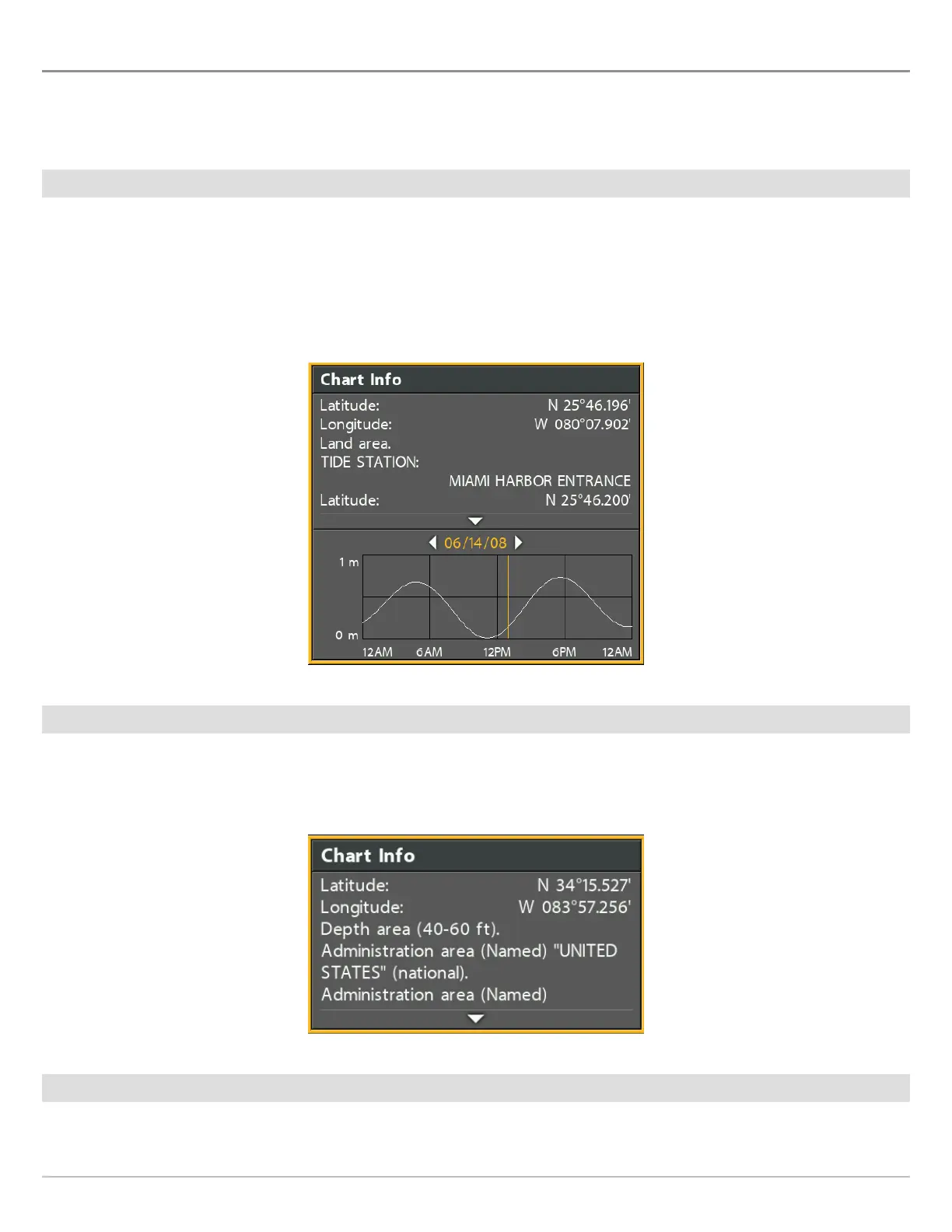
Chart Info: Tide Station
Chart Info: Cursor Position
 Loading...