94
Oxford Technical Solutions
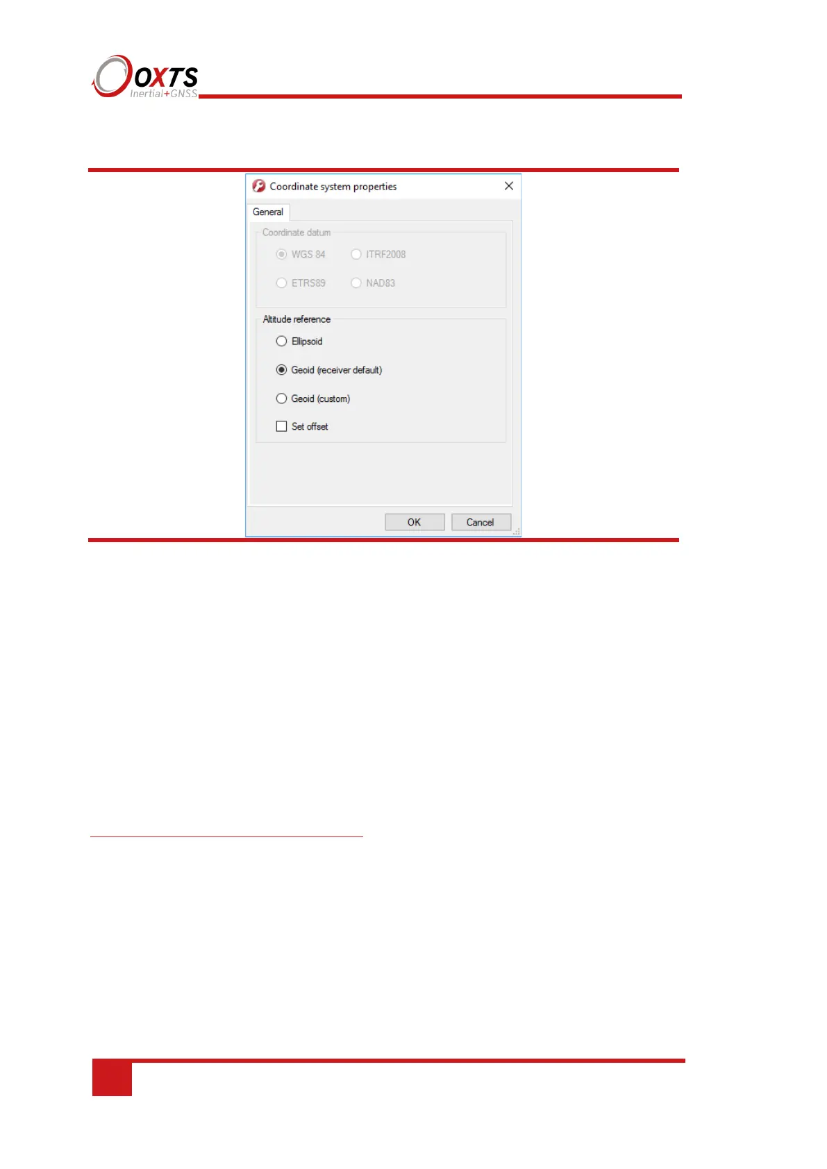
Figure 44. NAVconfig coordinate system properties window
From the Coordinate datum section you can choose which reference datum to output
latitude and longitude relative to. The default system and the standard for GPS is the
WGS 84 datum.
Note: Currently outputs will only reference datums other than WGS 84 in post-
processing. Real-time outputs will still be referenced to WGS 84 even if another option
is selected.
The Altitude reference can be compared to either ellipsoidal or geoidal height. If
Ellipsoid is selected, the altitude will be output with respect to the reference ellipsoid
selected in the coordinate datum section. If Geoid (receiver default) is selected, the
altitude will be relative to the geoid used in the GNSS receivers. A Custom geoid file
can be used for local variations. To download supported geoid files, go to
http://support.oxts.com/local-geoid-files/. The UGF file must be saved in
C:\Users\username\Documents\OXTS\Shared\Custom geoid files. Once the file is
downloaded and saved in this location, it can be selected from the dropdown box.
A constant offset to the specified altitude reference can be applied by checking the Set
offset box typing in a value into the cell.
Advanced
Adjustment: click … button to open settings window.