How to use the map
Most of the information provided by your navigation system can be seen on the map. You need to be-
come familiar with how the information appears on the map.
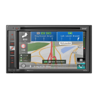
How to read the map screen
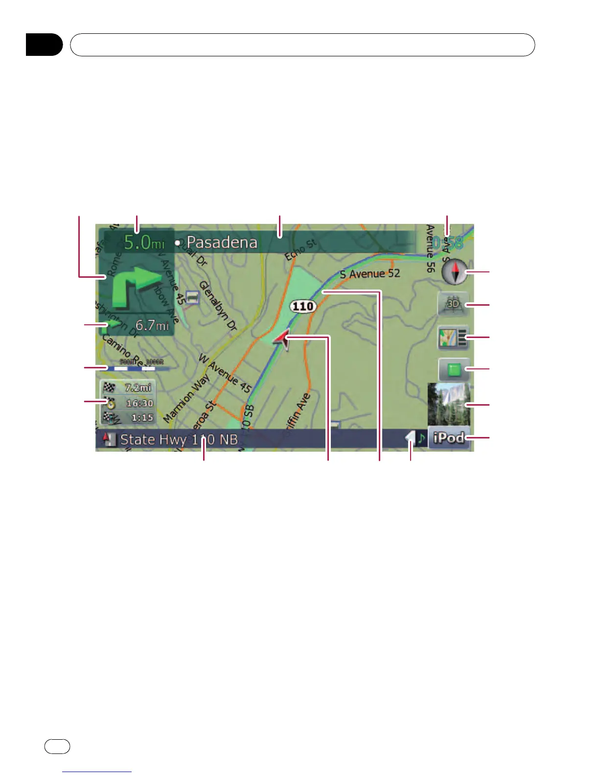
This example shows an example of a 2D map screen.
23 4
5
6
7
8
9
a
bcde
f
g
h
1
p Information with the mark (*) appears only
when the route is set.
p Depending on the conditions and settings,
some items may not be displayed.
1 Next direction of travel*
When you approach a guidance point, this ap-
pears green. Touching this item enables you
to hear the previous guidance again.
p For more information about the direc-
tion symbol, refer to Supplemental infor-
mation about directions on page 167.
2 Distance to the guidance point*
Shows the distance to the next guidance
point.
3 Name of the street to be used (or next gui-
dance point)*
4 Current time
5 Compass
The red arrow indicates north.
6 Map mode selector
= For details, refer to Switching the map
between 2D and 3D on page 22.
7 Shortcut to the “Map Confirmation
Screen”
Touching this shortcut enables the screen to
switch to the “Map Confirmation Screen” di-
rectly with the current position or the cursor
position centered.
= For details, refer to What you can do with
the “Map Confirmation Screen” on page
36.
8 Stop key for the dummy run
Basic operation
En
20
Chapter
02
 Loading...