61
Mission Operation
Lock Map to UAV
The map stays focussed on the UAV.
Button switches from:
• unlocked, • locked to UAV,
• locked to UAV & target
Select Map
The list includes online and ofine maps.
To use online maps, make sure QBase/
the tablet is connected to the internet.
Message dialog
Info, Warning, Error
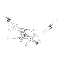
UAV Type
• Displays wind speed, direction, groundspeed & airspeed.
• Transparent UAV icon: estimated shadow (based on time &
coordinates).
Sensor Footprint
• Shows the part of the ground visible in the sensor view.
• The dashed line connects the UAV with the position of the
sensor screen crosshair on the ground.
Pan to …
Select the button Pan to if you wish to
pan to the UAV, to the mission or if you
wish to search for an address.
Map Settings
Adjust the display settings of the map.
Switch to 3D view.
Plot
Live Elevation Plot (Plots)
• Current altitude above ground (AGL)
• Current altitude above mean sea level (MSL)
• Altitude of the last 10 seconds
• Predicted altitude for the next 50 seconds.
Zoom in
Zoom out
MIXED
Both the SRTM data set and the user provided custom ele-
vation les are used as data sources. This is the case if not all
ight path elements are covered by the user provided le.
Missing Elevation
One or more SRTM elevation les could not be down-
loaded. This can be caused by the following reasons:
- A connection error occurred.
- The requested elevation data is not available. This applies to
regions which are not covered by the SRTM data set.
GDAL
The user provided custom elevation les
are used as the single data source.
SRTM Downloading
The required SRTM elevation les are
currently being downloaded.
Sensor Screen
Reduced functionality of the sensor screen
Switch to sensor screen
Hide/show sensor screen
8