75
Mission Operation
8
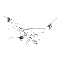
Retransition Altitude ATO (above take-off)
Denes the hover altitude at the end of the retransition. If the ight area allows for it, set the
retransition altitude as low as possible in order to save energy by reducing the hover duration
to a minimum.
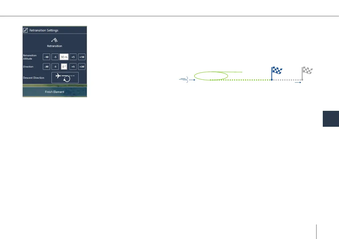
~20 m deviation
per 1m/s tailwind
Example: Tailwind Retransition
Waypoint
Direction
• It is recommended to set
the direction against the
wind direction.
• In case it is not possible
to carry out the retransi-
tion against the wind direction, be aware that the real retransition location does not
match the retransition waypoint that was set in QBase (~ 20 m drift per 1 m/s tail wind).
• If there is an obstacle in the retransition track, make sure the retransition altitude is 20 m
(65.6 ft) higher than the obstacle.
Descent Direction
• Before the retransition, the UAV enters the descent circle automatically in order to descend to the required retransition
altitude.
• The radius of the circle is by default set to 60 m (197 ft) and cannot be changed.
• In case no link reestablishing waypoint is set, the UAV will use the descent circle as the link reestablishing waypoint.
• Set the direction of the circle depending on the surrounding and obstacles.
If there is an obstacle in the ight track of the descent circle, make sure the retransition altitude is at least
20 m (65.6 ft) higher than the obstacle.