| 19
Charts | NSO-II Operator Manual
Positioning the chart on the panel
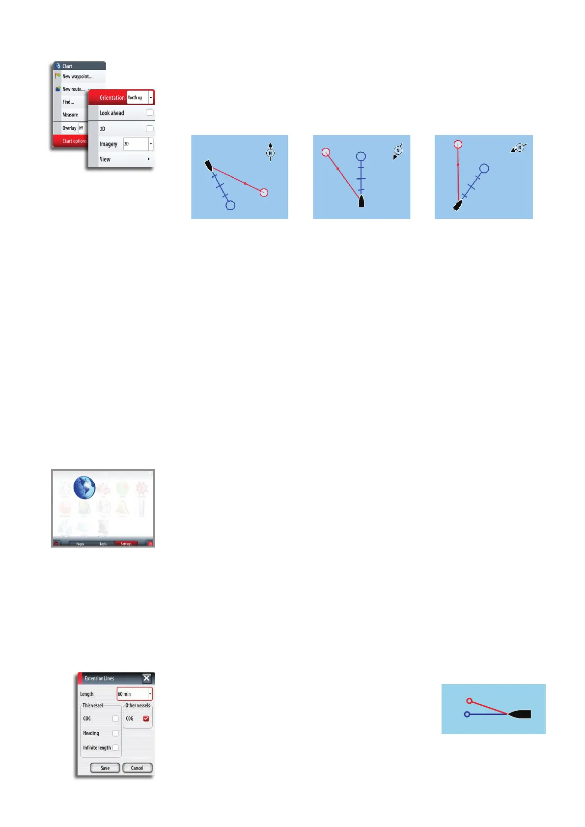
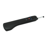
Chart orientation
Several options are available for how the chart is rotated in the panel. The chart
orientation symbol in the panel’s upper right corner indicates the north direction.
North up Heading up Course up
North up
Displays the chart with the north direction upward. Corresponds to the usual orientation
of nautical charts.
Heading up
Displays the chart with the vessel’s heading directly up on the chart image. Heading
information is received from a compass. If heading is not available, then the COG from the
GPS will be used.
Course up
Rotates the chart in the direction of the next waypoint when in navigation mode. This
option works only when there’s an active route. If no route is active the heading up
orientation will be used until a route is made active.
Look ahead
This option centres the chart slightly forward of your vessel so that you can maximize your
view ahead.
Chart settings panel
Settings and display options made in the Chart settings page are common for all chart
panels.
For optional chart panel settings, refer the illustration on page 17.
3D boat selection
Determines which icon to use on 3D charts. See “Chart panel” on page 17.
Range Rings
Turns on/o range rings on the chart.
The range rings can be used to present the distance from your vessel to other chart
objects.
The range scale is set automatically by the system to suit the chart scale.
Vessels’ extension lines
Sets the length of the extension lines for your vessel and for
other vessels shown as AIS targets.
The length of the extension lines are either set as a xed
distance, or to indicate the distance the vessel will move in
the selected time period.
Own vessel heading is based on information from the active
heading sensor and COG from active GPS sensor.
For other vessels COG data is included in the message received from the AIS system.
COG
Heading