You can also start the measuring function without an active cursor. Both measuring icons are
then initially located at the vessel position. The grey icon follows the vessel as the vessel
moves, while the blue icon remains at the position given when you activated the function.
You terminate the measuring function by selecting the Finish measuring option or by
pressing the X key.
Saving waypoints
You can save a waypoint at a selected location by positioning the cursor on the panel, and
then selecting the new waypoint option in the menu.
In the Chart and Nav panels, you can save a waypoint at the vessel position, when the cursor
is not active, by selecting the new waypoint option in the menu.
If your unit has a MARK key, you can press this key to immediately save a waypoint. If the
cursor is active, the waypoint is saved at the cursor position. If the cursor is not active, the
waypoint is saved at your vessel's position.
Creating routes
You can create routes as follows on the chart panel.
1. Position the cursor on the chart panel
2. Select New followed by New route in the menu
3. Tap the chart panel to position the first routepoint
4. Continue positioning the remaining routepoints
5. Save the route by selecting the save option in the menu.
Ú
Note: For more information, refer to "Waypoints, Routes, and Tracks" on page 37.
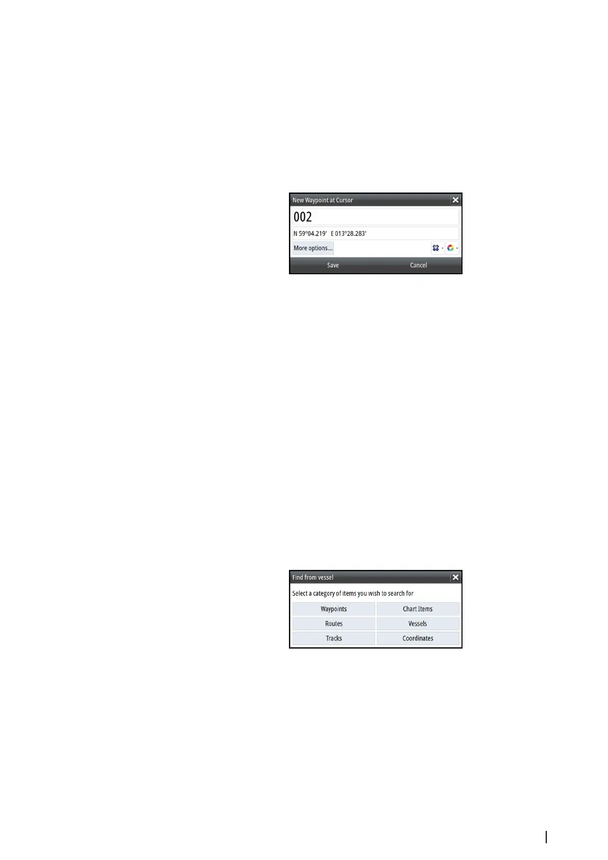
Find objects on chart panels
You can search for other vessels or various chart items from a chart panel.
Activate the cursor on the panel to search from the cursor position. If the cursor is not active,
the system searches for items from the vessel's position.
Ú
Note: You must have a SIRIUS data package subscription to search for fueling stations
and an AIS receiver connected to search for vessels.
3D charts
The 3D option provides a three dimensional graphical view of land and sea contours.
Ú
Note: All chart types work in 3D mode, but without 3D cartography for the appropriate
area the chart appears flat.
When the 3D chart option is selected, the Pan and the Rotate icons appear on the chart
panel.
Charts | NSS evo2 Operator Manual
27