Jeppesen charts
All possible menu options for Jeppesen charts are described below. The Jeppesen features
and menu options can vary depending on the Jeppesen charts you use.
Jeppesen tides and currents
The system can display Jeppesen tides and currents. With this information it is possible to
predict the time, level, direction and strength of currents and tides. This is an important tool
when considering planning and navigation of a trip.
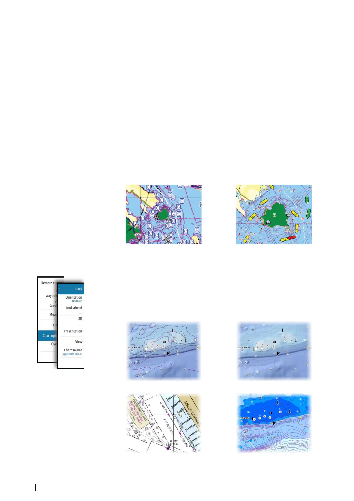
In large zoom ranges the tides and currents are displayed as a square icon including the
letter T (Tides) or C (Current). When you select one of the icons, tidal or current information
for that location are displayed.
Dynamic current data can be viewed by zooming inside a 1-nautical mile zoom range. At
that range, the Current icon changes to an animated dynamic icon that shows the speed and
direction of the current. Dynamic icons are colored in black (greater than 6 knots), red
(greater than 2 knots and less than or equal to 6 knots), yellow (greater than 1 knot and less
than or equal to 2 knots) or green (equal to or less than 1 knot), depending on the current in
that location.
If there is no current (0 knots) this will be shown as a white, square icon.
Static Current and Tide icons Dynamic Current icons
Jeppesen specific chart options
Orientation, Look ahead, 3D, and change Chart source (previously described in this section)
are common for all chart types.
Presentation
The charts can be displayed in different imagery styles.
Shaded relief No contours
Raster imagery
High resolution bathymetry
32
Charts | NSS evo2 Operator Manual