Using the GNSS Compass, Camera
GRS-1 Operator’s Manual
4-4
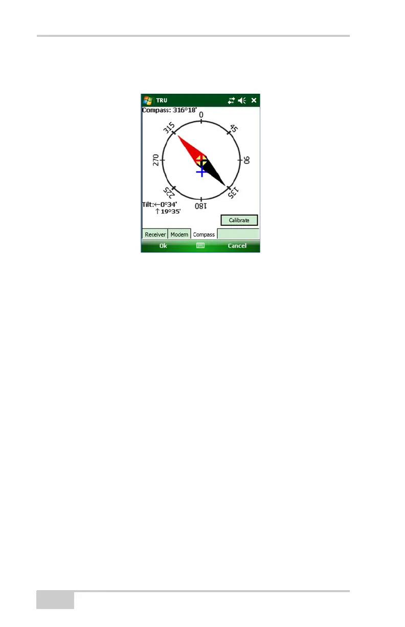
• Angle – the angle (azimuth) from North, in degrees.
• Tilt – the roll and pitch, from level, in degrees minutes.
Figure 4-1. View the Compass
Declination is the angle between magnetic north and true north. The
compass shows magnetic north. In order to determine the coordinates,
it is necessary to correct the declination.
Inclination is downward in the northern hemisphere. Because the
compass detects the horizontal component of a magnetic field,
azimuth accuracy worsens in the high magnetic area where a
magnetic horizontal component is small.
The compass function can be used in the area within +/- 70 degrees
magnetic latitude.
Magnetic Field Distortions occurs near ferrous materials and
material that disturbs a magnetic field, such as:
• The inside and surrounding area of a railroad, car, and ferro-
concrete building.
• A magnet, motor, and electric products, including digital camera,
personal computer, data collector, etc.
• The surrounding area of a plant that induces a magnetic field like
a high-voltage line and substation.
• The surrounding area of a metal (iron, nickel, and cobalt) mine.