3-8 Interference Mapping Interference Analyzer (Option 25)
3-16 PN: 10580-00349 Rev. H Spectrum Analyzer MG
A. Press the IA Mapping main menu key at the bottom of the screen.
B. Press the Save/Recall Points/Map submenu key.
C. Press the Recall Default Grid submenu key.
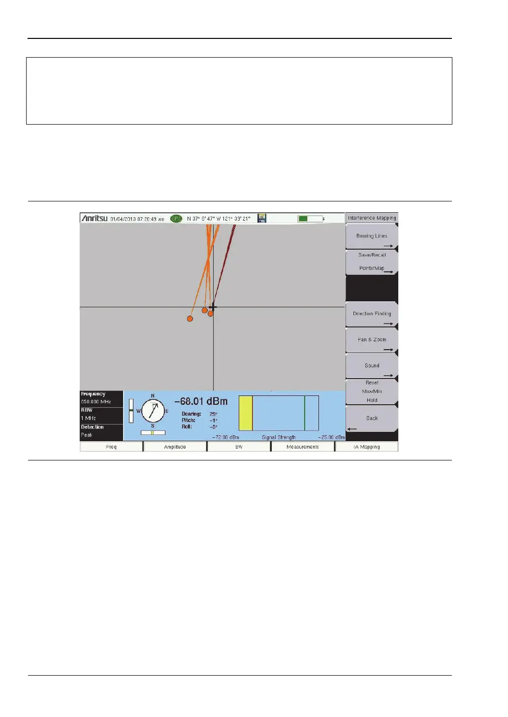
5. Map the interfering signal with the MA2700A.
Once you have a GPS signal from the connected Handheld Interference Hunter with a
directional antenna, and the GeoEmbedded map or the default grid map loaded on an
instrument, you can start locating interfering signals. The plus sign shows the current
location on the screen.
A. Press the Measurements main menu key then the Interference Mapping submenu key.
Note
When using the default grid the coverage area for Interference Mapping is fixed at
10 miles by 10 miles. The location will be centered on the default map. For
example, if you go to the east by 15 miles, then there will be an arrow indicating
where you went off the map. You can at this point load a new Default Grid and the
current location will be at the center of the display.
Figure 3-9. Locating an Interfering Signal with the MA2700A and the Default Grid
ООО "Техэнком" Контрольно-измерительные приборы и оборудование www.tehencom.com
 Loading...