26
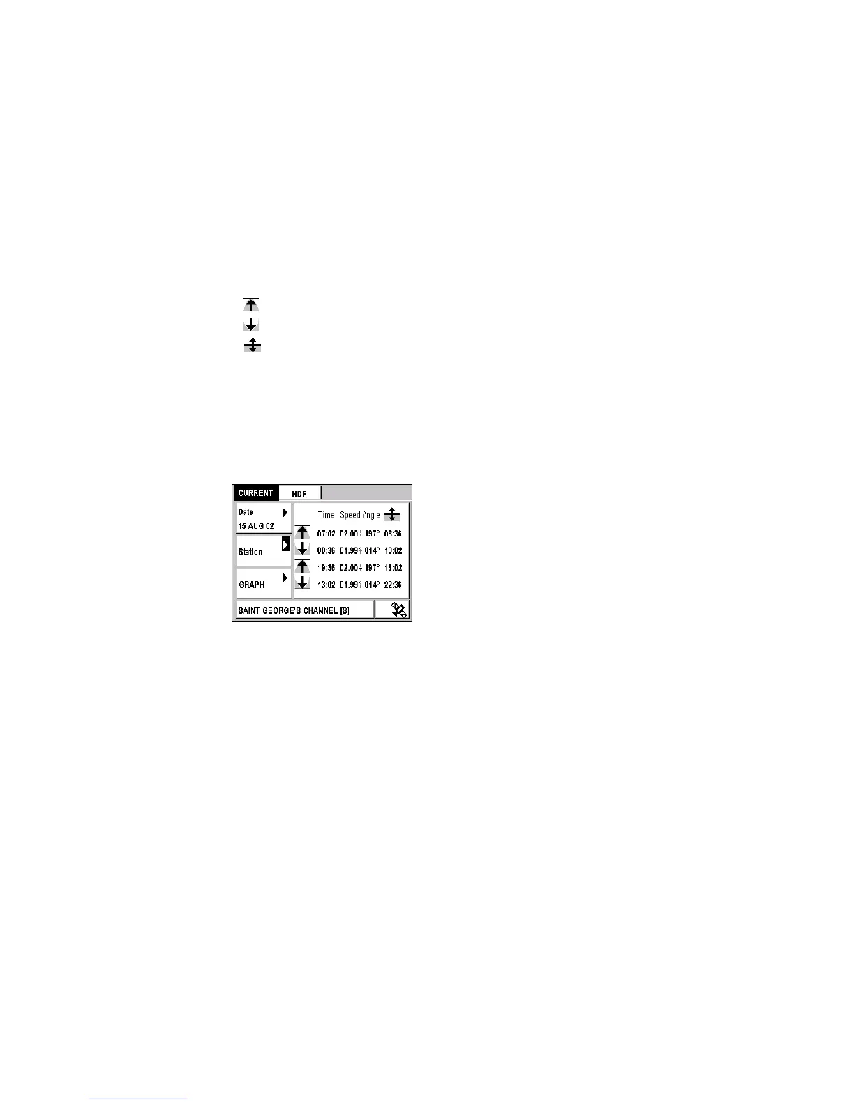
Current Tab
This tab displays the time of the maximum current, its speed, its angle
(i.e. its direction) and the time of the slack water, for a date and station
selected from the loaded chart.
The
symbol indicates the maximum current of the rising tide.
The
symbol indicates the maximum current of the falling tide.
The
symbol indicates the time of the slack water before inversion of
the current.
Example: At the Saint Georges Channel station on 15 August 2002, the
maximum current of the rising tide will occur at 7:02 a.m. and
7:36 p.m. It's speed will be 2 knots and its angle (i.e. its direction
with regard to True North) will be 197 degrees. The maximum
current of the falling tide will occur at 12:36 a.m. and 1:02 p.m.,
its speed will be 1.99 knots and its angle will be 14 degrees. The
times of the slack water before inversion of the current are
displayed in the last column.
Note: The speed of the current is always expressed in knots.
Selecting Another Date
Position Æ CURRENT Tab Æ Date Æ Enter
Enter the desired date and then push Enter.
See Setting the Local Time or a Date.
Selecting Another Station
Position Æ CURRENT Tab Æ Station Æ Enter
Select a station from the loaded chart and push Enter.
See Selecting a value from a list and MapSend BlueNav Charts.
Graph Function
Select Graph to display a graphical representation of the current for a
selected date and station.