62
7. Locating Your Position and Course
The Plotter screens represent your course on the chart, allow you to view
your current position, your waypoints, the direct route to the active
waypoint, etc.
You can load detailed MapSend BlueNav Charts of the zones in which
you are navigating at any time.
See MapSend BlueNav Charts.
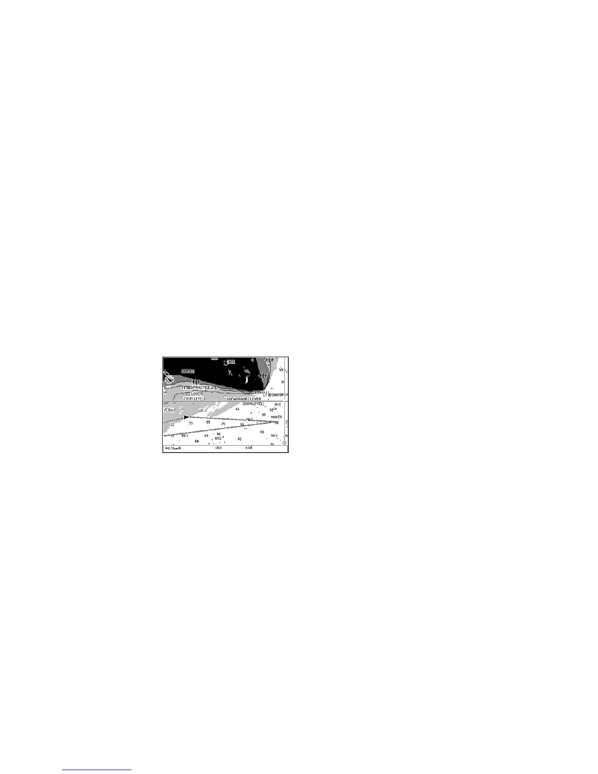
Plotter Screen No. 1
This screen can be displayed at any time by pushing the Plot button once
or twice.
Example: The screen below shows your vessel moving toward the waypoint
Wreck. Your vessel is represented by an isosceles triangle whose
point corresponds to your course, and your track is represented by
a dotted line. The two hachured lines represent the direct line and
the mobile to waypoint line.
Note: If the screen that appears after you push the Plot button is
different, push the Plot button again.
Information Displayed
Your active track is always displayed. The other information displayed
depends on the choices you make in the Plot, Chart and Route/Track
menus.
See Plotter Menu and Chart Menu to select the display options.
See Route Menu to activate the track display.
Chart
The chart of the segment in which you are navigating is automatically
displayed based on your calculated position.