35
Reference section 1 — Using the Chart Screen
Setting up the chart screen (Gold Charts)
Reference Manual Revision D
Navaids
The ON setting displays navaids from the
Navionics chart cartridge, and the OFF
setting hides the nav aids.
Obstructions / rocks / wrecks
Charted objects are shown.
Ports and services
Locations of ports, their names, and many
available services are shown.
Traffic lanes
Lanes where special rules may be in effect
are shown.
Vegetation / seabed
Surface vegetation and seabed composi-
tion descriptions are shown.
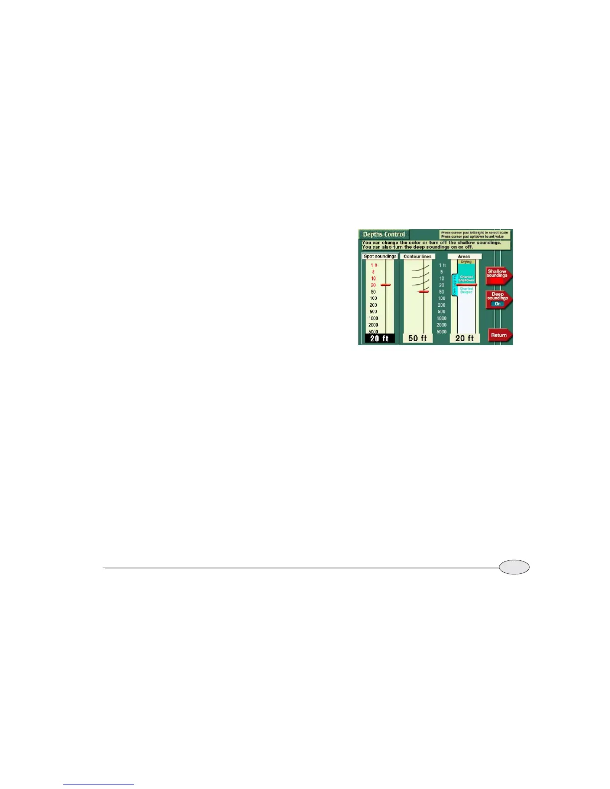
Displaying depths
Press Depths control on the CHART DETAIL
screen to choose how water depths are
displayed. You can control the display of
spot soundings, depth contour lines, and
shaded areas. Press the cursor pad left or
right to choose the soundings, contours or
areas column. Then press the cursor pad
up or down to move the slider as described
below.
Spot soundings
Spot soundings in shallow areas can be
displayed in black or red digits, or not
displayed at all. Spot soundings in deep
water can be displayed or hidden.
Press the cursor pad up or down to set the
depth you wish to be considered as
shallow.
Press the Shallow soundings key to
choose whether shallow digits are red,
black, or not displayed. Press the Deep
soundings
key to choose whether or not
deep soundings are displayed.
Note that the absence of soundings in a
particular area does not guarantee deep
water — it’s possible that soundings are
simply missing from that area.


 To Next Page