Do you have a question about the NorthStar 951X and is the answer not in the manual?
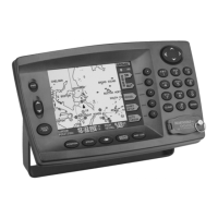
Congratulates the user and introduces the GPS chart navigator.
Explains how to navigate and utilize the information in the manual.
Provides contact information for obtaining assistance and resolving issues.
Details the procedure for activating and deactivating the device.
Explains how to view the built-in world map and chart data.
Guides users on how to view current location data on the screen.
Provides instructions for setting a destination and initiating navigation.
Presents a general summary of the unit's combined navigation capabilities.
Offers essential tips for preserving the unit's optimal performance and longevity.
Lists and briefly describes the unit's primary GPS and navigation functions.
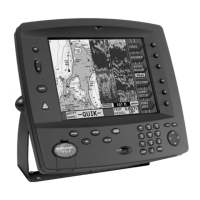
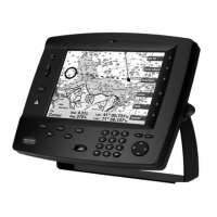
Explains the purpose and use of the five main function keys.
Details advanced capabilities like chart plotting, Loran TDs, and TideTrack.
Compares the advantages and characteristics of GPS and Loran navigation systems.
Explains the DGPS system for enhanced positioning accuracy.
Describes Loran's performance and its role in navigation.
Details how to turn the unit on and off using the power key.
Explains how to save current position as a waypoint or activate MOB mode.
Describes the role of the five function keys in accessing unit features.
Details how the POSITION key displays location information on various screens.
Explains how the STEER key guides navigation to a designated waypoint.
Describes the function of the five round menu keys on the display's right side.
Explains how to move the cursor on the chart and select data on screens.
Details how to enter numbers, letters, and special characters for data input.
Explains how the unit provides alerts for various conditions and how to acknowledge them.
Guides on showing the vessel's current location and related data on the chart screen.
Explains the nature, detail levels, and limitations of electronic chart data.
Describes the symbols and representations of buoys, lights, and landmarks on charts.
Details how to move and use the cursor to select points and objects on the chart.
Explains how to zoom in and out to view different scales of the chart data.
Describes how the chart is displayed with the vessel centered.
Explains how to view different areas of the chart without centering the vessel.
Guides on how to determine distances and bearings between points on the chart.
Covers options for customizing displayed chart data and parameters.
Details how to view critical navigation data like lat/lon, COG, and SOG.
Explains how the GPS receiver provides primary position data and its accuracy.
Covers how to use DGPS for superior accuracy and its status indicators.
Explains how to use Loran coordinates and interface with a Loran receiver.
Describes the feature that converts GPS data to Loran TDs for display.
Defines what a waypoint is and its role in navigation and chart display.
Details the methods for entering new waypoints graphically or numerically.
Explains how to designate waypoints as hazard zones with associated alarms.
Covers the different ways to view stored waypoints (chart, local, alpha lists).
Guides on changing waypoint names, symbols, coordinates, and avoidance radii.
Explains the process for sharing waypoint and route data between compatible units.
Details how to copy, edit, or back up waypoints and routes using a PC.
Defines routes and their potential uses in marine navigation.
Guides on graphically constructing routes by selecting points on the chart.
Explains how to build routes using pre-existing waypoints from stored lists.
Describes how to automatically log a route by marking waypoints while traveling.
Details how to modify routes by changing names, adding/removing waypoints, or reordering.
Guides on navigating to points directly selected on the chart screen.
Explains how to navigate to numerically entered temporary waypoints.
Details how to select and navigate to waypoints from stored lists.
Explains how to use steering screens for precise guidance to a waypoint.
Guides on following stored routes and managing navigation along route legs.
Explains how to re-establish the course line after deviations or obstacles.
Explains the nav log's purpose in planning and monitoring trip progress.
Details how to navigate route waypoints in the reverse order.
Explains how to add waypoints to the current trip log.
Describes how to halt the active navigation process and related displays.
Guides on resuming navigation after it has been stopped or interrupted.
Explains the various automatic alarms, their causes, and how to manage them.
Details how to change the brightness level of the display screen.
Explains the TideTrack feature for displaying tide information from NOAA stations.
Guides on setting the local time zone for accurate time displays.
Allows users to adjust settings for distance, speed, time, and lat/lon displays.
Explains the unit's ability to calculate distances via great circle or rhumb line.
Allows selection of units for measurements like nautical miles, knots, km, or mph.
Covers options for displaying time in 12-hour or 24-hour format.
Allows adjustment of lat/lon display precision to degrees/minutes or degrees/minutes/seconds.
Defines the limit for saved waypoints before overwriting older ones.
Explains the different color schemes available for the 952 model's display.
Covers settings for navigation source, magnetic variation, and waypoint advancement.
Details how to select GPS, Phantom Loran, External Loran, or DEMO mode.
Allows selection of True, Automatic, or Manual magnetic variation settings.
Explains how the unit advances to the next waypoint.
Allows adjustment of the distance that triggers an arrival alert for a waypoint.
Guides on selecting the correct datum for chart and position accuracy.
Covers settings for GPS speed averaging and beacon frequency.
Allows users to turn the DGPS functionality on or off.
Covers configuration of NMEA and RS-232 ports for external device communication.
Provides access to serial numbers, software versions, and self-test results.
Details how to perform internal tests on the unit's keypad buttons.
Explains how to bypass the safety feature that detects an open cartridge door.
Lists the core navigation functionalities including chart display and modes.
Outlines how the unit obtains and processes position information from GPS.
Describes the graphical displays used for precise steering guidance.
Summarizes features for creating, editing, and transferring waypoints and routes.
Lists capabilities for navigating to specific points and following routes.
Summarizes the trip logging and progress monitoring functions.
Lists features related to displaying tracks, waypoints, and avoidance areas.
Highlights other features like anchor watch, alarms, and GPS clock.
Defines absolute and repeatable accuracy in the context of navigation data.
Defines Global Positioning System and its navigation capabilities.
Defines a waypoint as a specific location for navigation purposes.