Oxford Technical Solutions Ltd Page 15 of 110
Hardware description
Overview
The RT3000 v4 is a flagship GNSS-aided inertial navigation system. It combines dual multi-constellation, multi-
frequency RTK GNSS receivers with a tactical-grade multi-core IMU array to provide a highly accurate 3D
navigation and dynamics reference solution. Additionally, the system includes 32 GB data storage and an on-
board processor running the real-time strapdown navigator and OxTS Kalman filter.
The dual receiver integration allows greater heading accuracy with wider antenna baselines and ensures stable
heading performance even when stationary and during low dynamics. The custom-built multi-core IMU
consists of multiple independent IMU sensors that each combine 6-axis MEMS gyros and accelerometers,
providing improved performance and redundancy. The sensor fusion between the GNSS receivers and inertial
sensors is done seamlessly in real-time for a continuous 100 Hz navigation output. Data is automatically
logged to the 32 GB eMMC for added data protection.
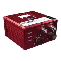
RT3000 v4
Survey-grade GNSS receivers provide high-accuracy position and velocity measurements even in high
multipath environments. Comes with dual frequency GPS, GLONASS, Galileo and BeiDou enabled as standard.
The RT3000 v4 is RTK capable and has dual antennas. 100 Hz, 200 Hz and 250 Hz versions are available. The
RT3000 v4 is able to run the OxTS RT-Range Hunter feature codes for ADAS testing.
RT3000 T v4
The RT3000 v4 also has RTK-capable Survey-grade GNSS receivers tracking GPS, GLONASS, Galileo and BeiDou
as standard. However, the GNSS receivers in the RT3000 T v4 support tri-frequency tracking. This enables the
RT3000 T v4 to track L-Band corrections necessary to receive Terrastar™ corrections in addition to the L1 and
L2 band required for RTK. The RT3000 T v4 is also able to run the OxTS RT-Range Hunter feature codes for
ADAS testing.
Dual antenna
Dual antenna systems provide high accuracy heading information and almost constant heading performance
under all conditions.
For aircraft or marine applications, or road vehicle applications on low-friction surfaces (e.g. ice), a dual
antenna system is recommended to maintain high accuracy heading.
Advanced processing in the RT allows relock to occur after five seconds of a sky- obstruction – unlike GNSS-
only systems which can take several minutes; in this time the RT’s heading will not have significantly degraded.
The fast relock time is made possible because the RT’s own heading is used to resolve the ambiguities in the
GNSS measurements. Resolution of these ambiguities is what normally takes several minutes.
The heading software in the RT enables significantly better performance and coverage compared to GNSS-only
solutions.