2.Checkthescreen.
Withthechartdisplayed,youshouldsee:
Yourboatposition(indicatesaGPSx).Yourcurrentposition
isrepresentedbyaboatsymbolorsolidcircle.Yourpositionis
alsodisplayedinthedatabarunderVESPOS.
Asolidcircleonthechartindicatesthatneitherheadingnor
CourseOverGround(COG)dataisavailable.
Note:Raymarinerecommendsthatyoucheckthedisplayed
vesselpositioninthechartapplicationagainstyouractual
proximitytoaknownchartedobject.GPSreceiverstypicallyhave
anaccuracyofbetween5and15m.
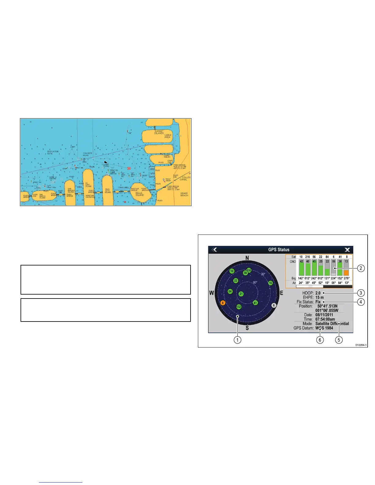
Note:AGPSStatusscreenisavailablewithintheSetupmenuof
Raymarinemultifunctiondisplays.Thisprovidessatellitesignal
strengthandotherrelevantinformation.
GPSsetup
TheGPSsetupoptionsenableyoutocongureaconnectedGPS
receiver.
TheGlobalPositioningSystem(GPS)isusedtopositionyourvessel
onthechart.YoucansetupyourGPSreceiverandcheckitsstatus
fromtheGPSStatusoptionintheSystemSettingsmenu.For
eachtrackedsatellite,thescreenprovidesthefollowinginformation:
•Satellitenumber.
•Signalstrengthbar.
•Status.
•Azimuthangle.
•Elevationangle.
•Asky-viewtoshowthepositionoftrackedsatellites.

 Loading...


