58 |
Using the simulator | GN70/MX610/MX612 Operator and Installation Manual
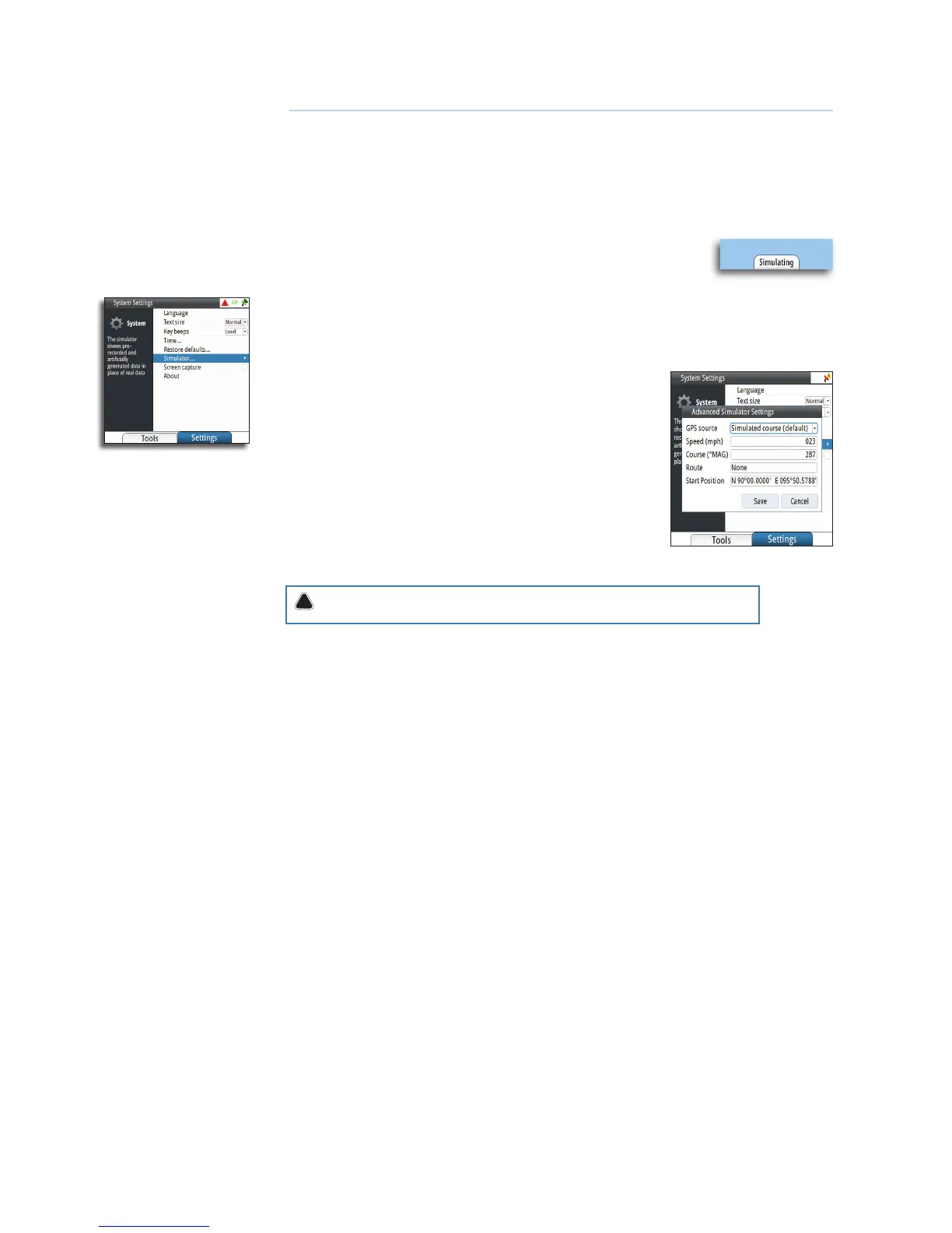
Using the simulator
Simulator mode
The simulation feature will let you see how the unit works in a stationary position and without
being connected to the GPS antenna.
You can use the simulator to help you become familiar with your unit before using it out on
the water.
When the simulator is toggled on, this is indicated in the lower part of
the display.
Advanced simulator settings
The advanced simulator settings allow you to define how to run the simulator. When the
settings are saved, these will be used as default when starting the simulator mode.
GPS source
Selects where the GPS data is generated from. The selections
are: Simulated course or Simulated route (default).
Speed, course and route
Used to manually enter values when GPS source is set to
Simulated course or Simulated route.
Set start position
Moves the vessel to current Lat/Long position.
Warning: Do not use the MX61x for navigation when in Simulator mode.
Simulation setup
To activate the simulator, do the following:
1. Press the MENU key.
2. Scroll to Tools and Settings then press the ENT key.
3. Scroll to System icon then press the ENT key.
4. Scroll down to Simulator, then press the ENT key.
5. Scroll to Simulator Settings then press the ENT key. This will bring up the advanced simulator
settings dialog box.
6. Select Simulated course (default) setting.
7. Scroll down to Speed (Kn) and press the ENT key. Enter the desired speed in knots using the
numeric keypad.
8. Scroll to OK button, then press the ENT key to confirm your entry.
9. Scroll to Heading then press the ENT key.
10. Enter the heading in degrees using the numeric keypad. Press the ENT key.
11. Highlight the OK button and then press the ENT key.
12. Scroll down to Start Position field then press the ENT key.
13. Using the numeric keypad, enter the Lat/Lon coordinates where you want to start the naviga-
tion.
14. Press the ENT key after the last digit is entered.
15. Highlight SAVE button then press the ENT key.
16. Press the NAV key to exit and verify the displayed Lat/Long.
Using the simulator mode, you can create waypoints, routes and calculate range and bearing
to destination waypoint.
11