Cloud Tops (ADS-B)
The Cloud Top (ADS-B) weather layer is included with all subscriptions when connected to
Sentry. Cloud tops are a forecast map layer from the National Weather Service (NWS). Cloud
tops are derived from satellite temperature sensors using the High-Resolution Rapid Refresh
(HRRR) model.
Cloud Tops are only available for the continental United States. Cloud tops are not provided for
Alaska, Hawaii, Guam, or Puerto Rico. The Cloud Top forecast is generated by NWS every
hour and transmitted over ADS-B every 15 minutes.
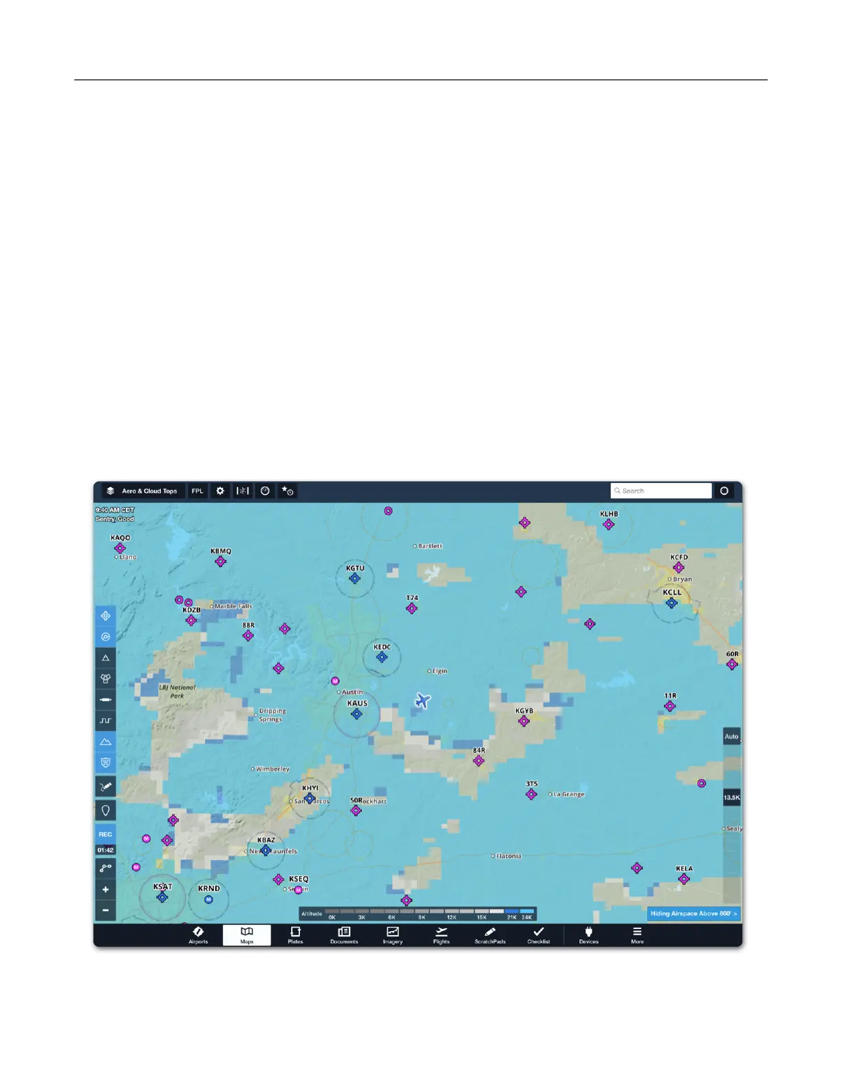
Select Cloud Tops (ADS-B) from the layer selector and use the altitude slider on the right side
of the map to filter clouds with tops below the selected altitude. Cloud Tops (ADS-B) is a useful
tool for determining if flight can be conducted in visual conditions above the clouds. Forecast
cloud tops that exist at or above the selected altitude are depicted on the map according to the
color-coded scale. Tap Auto above the altitude slider to automatically display cloud tops at and
above your current GPS altitude.