Icing (ADS-B)
The Icing (ADS-B) weather layer is included with all subscriptions when connected to Sentry.
ADS-B icing is an NWS graphical forecast with a look ahead range of 150 nm to 250 nm.
Forecast icing severity and anticipated presence of super-cooled large droplets (SLD) are
provided for every 2,000 ft up to 24,000ft MSL. The altitude slider on the right side of the map
is displays the icing data at various altitudes. This information comes from the NWS Forecast
Icing Potential model, available only in the continental United States. Forecast icing
information is not provided for Alaska, Hawaii, Guam, or Puerto Rico. This model is run on an
hourly basis. The transmission interval is every 15 minutes.
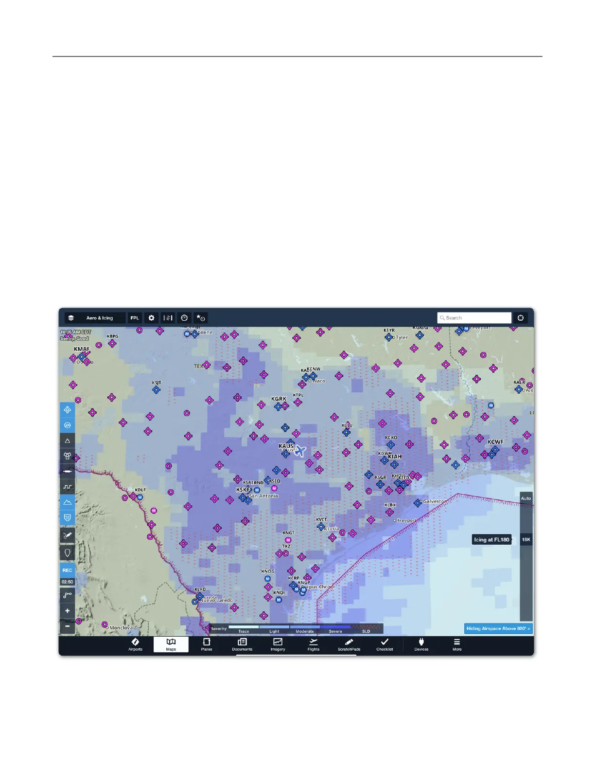
Select Icing (ADS-B) and use the altitude slider on the right side of the map to display forecast
icing severity and anticipated presence of SLD. Tap Auto above the altitude slider to
automatically display icing information at your GPS altitude.