104
©
2022 DJI All Rights Reserved.
MATRICE 30 SERIES User Manual
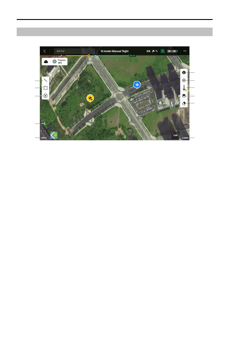
Map View
1
2
3
4
5
6
7
8
9
10
11
1. Tap to draw lines on the map.
2. Tap to draw an area on the map.
3. Tap to clear all points, lines and annotations on the current view. If the user is logged in on DJI
FlightHub 2, performing this action will not clear the annotations distributed by DJI FlightHub 2.
4. PinPoint: Press the L1 button on the remote controller to add a PinPoint in the center of the view.
Press and hold on the L1 button to expand the PinPoint settings panel, which allows users to
change the PinPoint color, view all target points, or set the default display of the target point in
video transmission view.
5. Switch to FPV Camera View: Press the L3 button on the remote controller to switch to FPV camera
view.
6. Switch to Gimbal Camera View: Press the R3 button on the remote controller to switch to gimbal
camera view.
7. Tap to clear the ight track of the aircraft.
8. Map Layer Selection: Tap to select a satellite or street map (standard mode) according to operation
requirements.
9. Map Lock: If enabled, the map cannot be rotated; if disabled, the map can rotate freely.
10. Recenter Button: Tap to quickly center the remote controller in the view.
11. GEO Zone Layer Management: Tap to view all GEO Zone layer information and enable or disable
the GEO Zone layer.
 Loading...