Rev #37
Version 8.0
April 2021
Page 32 of 121
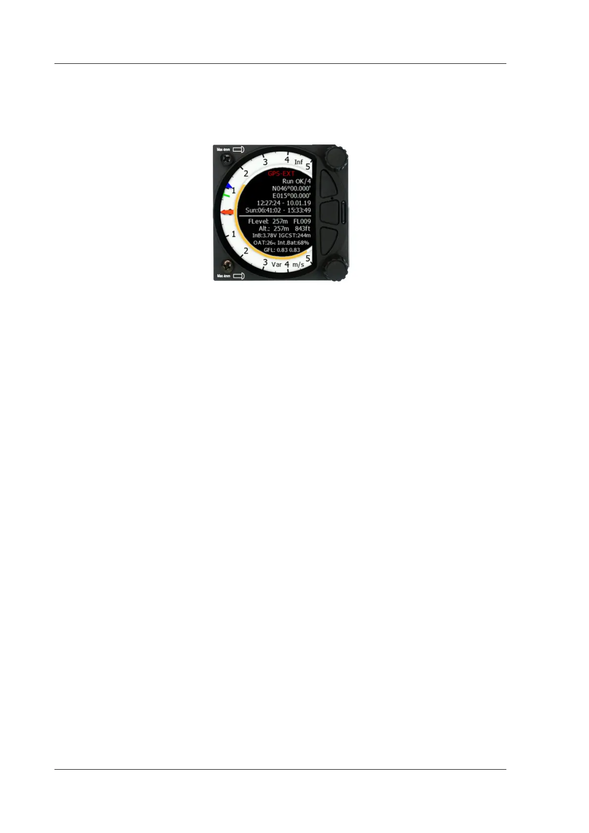
5.2 Info Mode
The Info Mode gives you a snapshot of the GPS position, date and time along with the Flight
level, altitude, Battery status and FLARM status. The Flight Level equivalent is also available
in meters or feet as is the Altitude navbox.
Description:
• The logger status is displayed as Stop or Run. You can also set logger to be always
turned on (see Chapter 5.7.2.4).
• The GPS status is displayed as OK, BAD, NODATA together with the number of satellites.
• Latitude and longitude
• Local time and date
• Sunrise and sunset time.
• Flight level also in meters
• Altitude in meters and ft
• Battery status
• IGCAlt – IGC altitude (altitude read from the IGC sensor)
• FLARM status (TX – transmits data / and a number of received FLARM devices)
• OAT – outside air temperature
• GFL – G-force levels. Minimum and maximum recorded G-force level
5.2.1 Quick Access Menu
A short press of the (lower) rotary button activates the Quick Access menu.