POS MV V4 User Guide
Theory of Operation
Copyright © Applanix Corporation, 2009
B-28
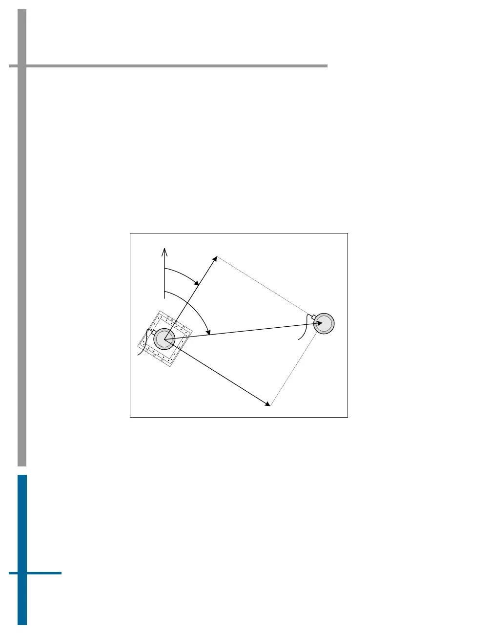
Because the geographical antenna baseline vector is referenced to true north,
it varies as the vessel changes course. However, the heading aiding data
required by POS MV is the heading of the antenna baseline referenced to the
x-axis of the IMU.
POS MV transforms the geographic antenna baseline vector Ф
ANT
to the
geographic IMU heading Ф
IMU
using the surveyed antenna baseline vector
12
rΔ
, which is the antenna baseline vector resolved in the IMU co-ordinate
frame.
Figure 74 illustrates these headings and angles.
Antenna 1
&
IMU
N
Antenna 2
Ф
ANT
Ф
IMU
12
rΔ
Y
IMU
Figure 74: Baseline Comparison
Where: Ф
ANT
= geographic antenna baseline vector - the
geographic vector of the line that joins the two
GNSS antennas; this vector varies as the
heading of the vessel changes
Ф
IMU
= geographic IMU vector - the geographic
heading of the IMU x-axis; this vector varies
as the heading of the vessel changes