Page 30
6.10 WIND SPEED AND DIRECTION INDICATION USING GPS
The wind speed and its direction are automatically calculated using the GPS info Tracking (“TRK”) and the
“ground speed (“Gs”) .
To determine the wind speed and its direction, you should make a “normal” turn, which has to be neither too
tight, nor too wide. It is also important to maintain constant airspeed during the turn.
For an accurate calculation at least a 360º turn must be completed.
This function uses the parameter (ADVANCED SETUP \ n. 21 WSEN) for the wind calculator sensibility (default 5)
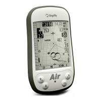
6.11 LAST THERMAL DIRECTION, DISTANCE, HEIGHT INFORMATION
The data: direction “BRG T”, distance “DST T” and altitude gain “A3” are shown
on the display when it is detected a thermal.
To define a thermal, this function uses the parameter (VARIOMETER SETUP \ n.
16 THET) to define the lift’s minimum duration in seconds.
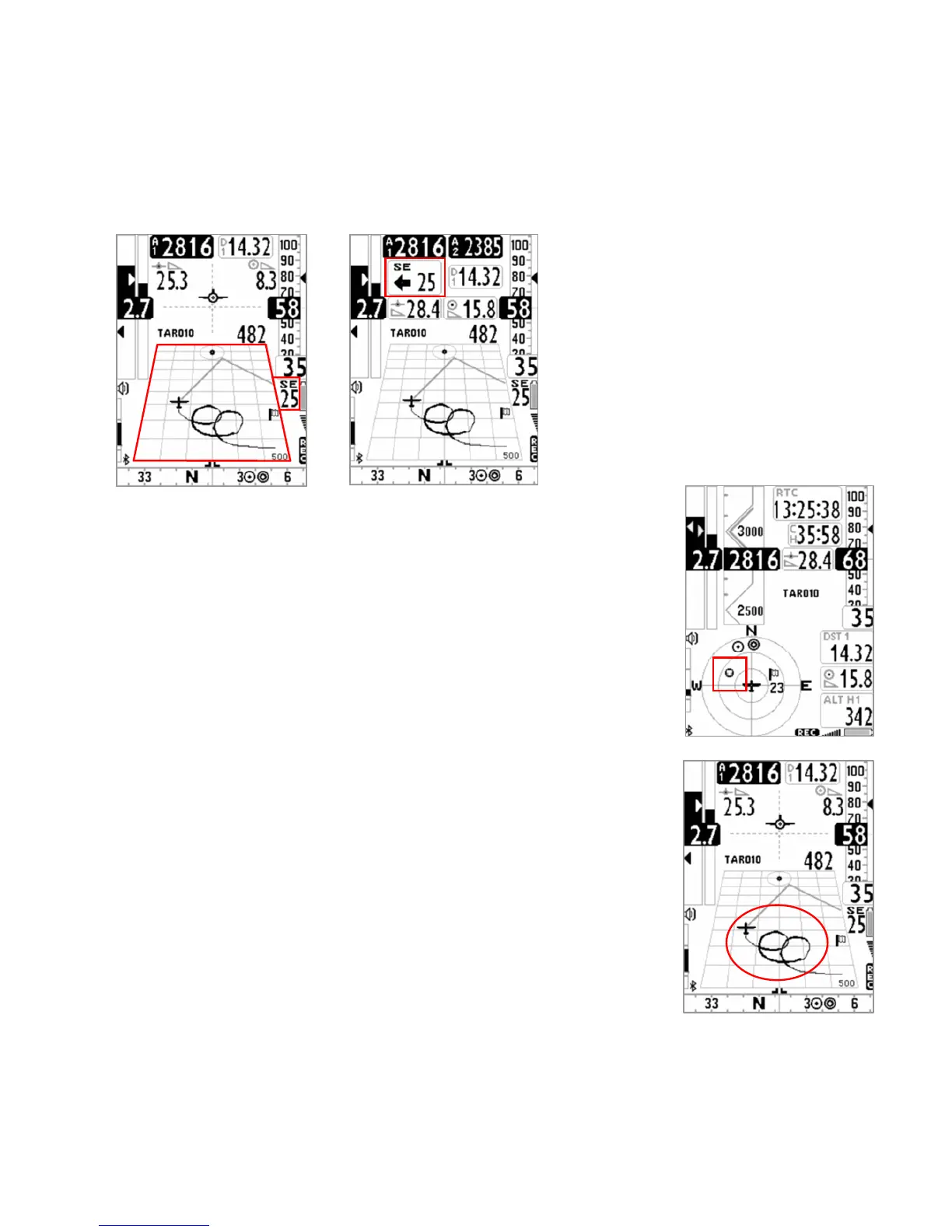
6.12 THERMAL TUTOR
Thermal tutor is an innovative function capable to help you to center thermals
becouse it draws the thermal track in the plotter using lines with changing
thickness : narrower when descending and thicker when climbing. So it becomes
very intuitive find the core of thermal.
Track on the plotter is drawn with a new zoom factor (autozoom) each time you
change kind of flight: from thermaling to gliding and vice versa.
Switch from gliding mode to thermaling mode when it feels a new thermal for
more than x seconds (VARIOMETER SETUP \ n. 16 THET) default=2 seconds.
When this happens plotter cleans up and zoom is rised to maximum capacity.
Switch from thermaling mode to gliding mode when it doesn’t reveal any more
thermal for more than x seconds (VARIOMETER SETUP \ n. 15 CRUT) default =30
seconds. When this happens plotter cleans up and the zoom is automatically set
on the basis of calculated distance between current position and current waypoint so both can be shown on the
plotter.
 Loading...