Page 31
7 WAYPOINT MANAGEMENT
7.1 DATABASE WAYPOINT COMPETITION AND WAYPOINT USER
Two waypoint databases are available :
Competition Waypoints (“WPT COMP”) and User Waypoints (“WPT USER”). For each database, 186 waypoints
may be saved.
To visualize the Waypoint list press the key
(“MEN” function) and select the desired WP list.
The Waypoints can be manually created or can be downloaded from a PC using the AirTools or GpsDump
software. On a MAC, GpsDump ‘MAC’ version is available. It is also possible to transfer the Waypoints from
Digifly AIR to the other via BT.
7.1.1 CREATING A NEW WAYPOINT MANUALLY
To create a new Waypoint, in the menu, put the cursor on the first
database’s dotted line, and then press the key
(“EDIT”
function).
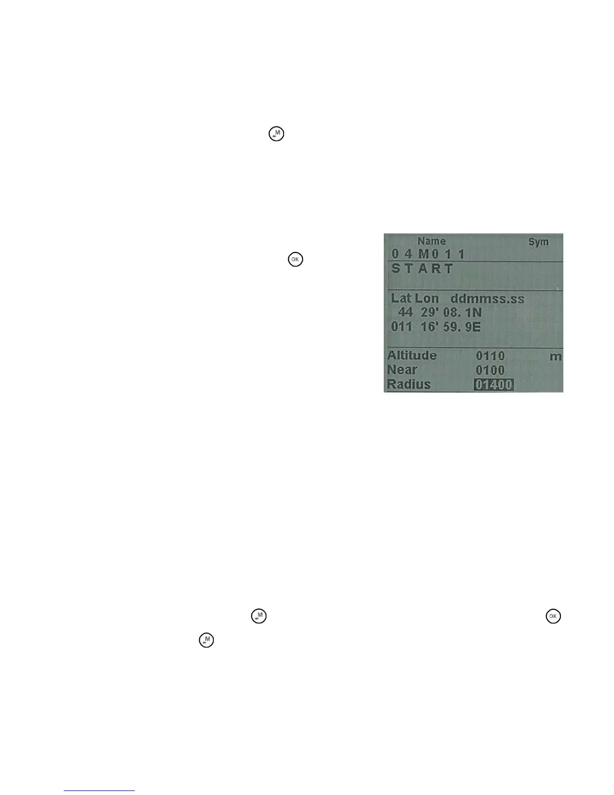
The “EDIT” function is described in the chapters 2.6.1 and 2.6.2.
Name: 6 characters, format aaaNNN (aaa = 3 alphanumeric
characters, NNN = waypoint altitude above sea level, in tens of
meters). Note: if the field NNN doesn’t contain three numbers, then
the navigation uses the field Altitude.
Sym : numbers from
0 to 9 or the letter A to identify an official
landing zone (Airfield)
Note : alphanumerical, 16 characters available
Lat / Lon: Latitude and longitude.
Altitude: altitude in meters. Note: this field is used only if the field NNN of the waypoint’s name doesn’t contains
three numbers.
Near: distance in meters that activates the fast frequency flight recorder (one second scan).
Radius : radius in meters of the waypoint’s cylinder
7.1.2 CREATING A NEW WAYPOINT USING THE CURRENT POSITION (MARK)
When the GPS acquires a valid position it is possible to save it in the instrument’s memory using the function
“MARK”.
From the GPS INFO page press the key
(long press) , the message " Save Mark ?" is shown, press the
key to confirm or press the
key to annul. The current position will be saved as a new Waypoint in the User
Waypoint list (“WPT USER”) with the format nnMaaa (aaa= altitude GPS in tens of meters) and the barometric
altimeter A1 will be synchronized with the value of the GPS altitude.
 Loading...