5 Layers and Instruments | 84
To add a signal
1. Select a latitude and a longitude signal from the Variable Explorer or the
Configuration Manager.
2. Drag and drop the signals onto a layer or layer tab of the configuration and
select the GPS Map instrument. For more information, see "To assign sig-
nals to a new instrument" on page99.
The map view appears and the track is displayed.
V8.6 tries to assign automatically the signals to the correct coordinates by
checking for "long" respective "lat" in the signal names. If the automatic sig-
nal assignment is incorrect, switch their assignment by clicking on .
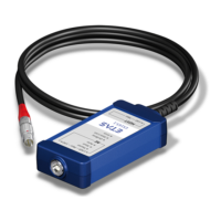
To add an Event signal
When adding event signals to a GPS map, the location where an event occurred is
indicated by .
If several tracks are displayed, for a unique identification the color of the icon has
the same color as the track. The color of the flash inside the icon represents the
event type (e.g. pause event, comment event, calibration activity, etc.).
To zoom
Do one of the following:
1.
To zoom in, click .
2.
To zoom out, click .
or
1. Use the mouse wheel to zoom in or out.
To zoom to show the complete track
1. Click , and the map will be zoomed that the track is completely visible.
To select a specific time range of the track
1. To see which track was driven during a specific time range, the Time Slider
is used. For more information, see "Time Navigation and Synchronization"
on page87.
When only a sub-time range is selected, this track is shown in dark blue,
while the track outside this time range is indicated in light blue.
To show cursors
In synchronized mode, cursors are shown as these are given by the master instru-
ment. Cursors can be moved directly in the GPS Map instrument or follow the
cursor's movement in the master instrument.
To delete a signal
Open the Configuration Manager and delete the respective signal from the
GPS Map view.
or
MDA V8 | User Guide