Garmin GPSMAP 695/696 Owner’s Manual
190-00919-00 Rev. G
163
Hazard Avoidance
Overview GPS Navigation Flight Planning Hazard Avoidance Additional Features Appendices Index
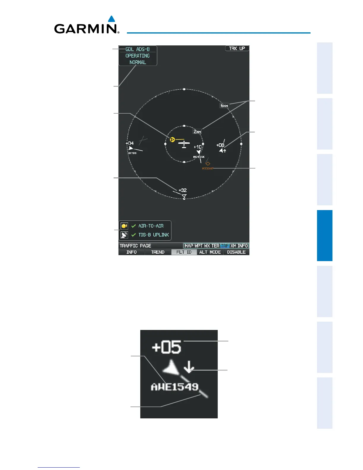
Traffic Page (GDL 39)
Traffic
Source
Traffic
Advisory
Traffic Display
Range Rings
Altitude/
Operating
Mode
Proximity
Advisory (PA),
800’ above,
Climbing
Surface
Traffic W/
Flight ID
Traffic System
Status Receiving
Air-to-Air and
TIS-B Traffic
Directional
Traffic, 3200
feet above
FLIGHT ID DISPLAY
The Flight IDs of other aircraft (when available) can be displayed on the Traffic Page.
When a Flight ID or call sign is received, it will appear below the corresponding traffic
symbol when enabled.
Aircraft
Identification (tail
number or Flight
ID number)
Example ADS-B Traffic Symbol
Traffic Absolute
Motion Vector
Relative Altitude (in
this case 500 feet
above own aircraft)
Altitude Trend (up
arrow indicates
climbing, down
arrow indicates
descending)
 Loading...


