Garmin GPSMAP 695/696 Owner’s Manual
190-00919-00 Rev. G
131
Hazard Avoidance
Overview GPS Navigation Flight Planning Hazard Avoidance Additional Features Appendices Index
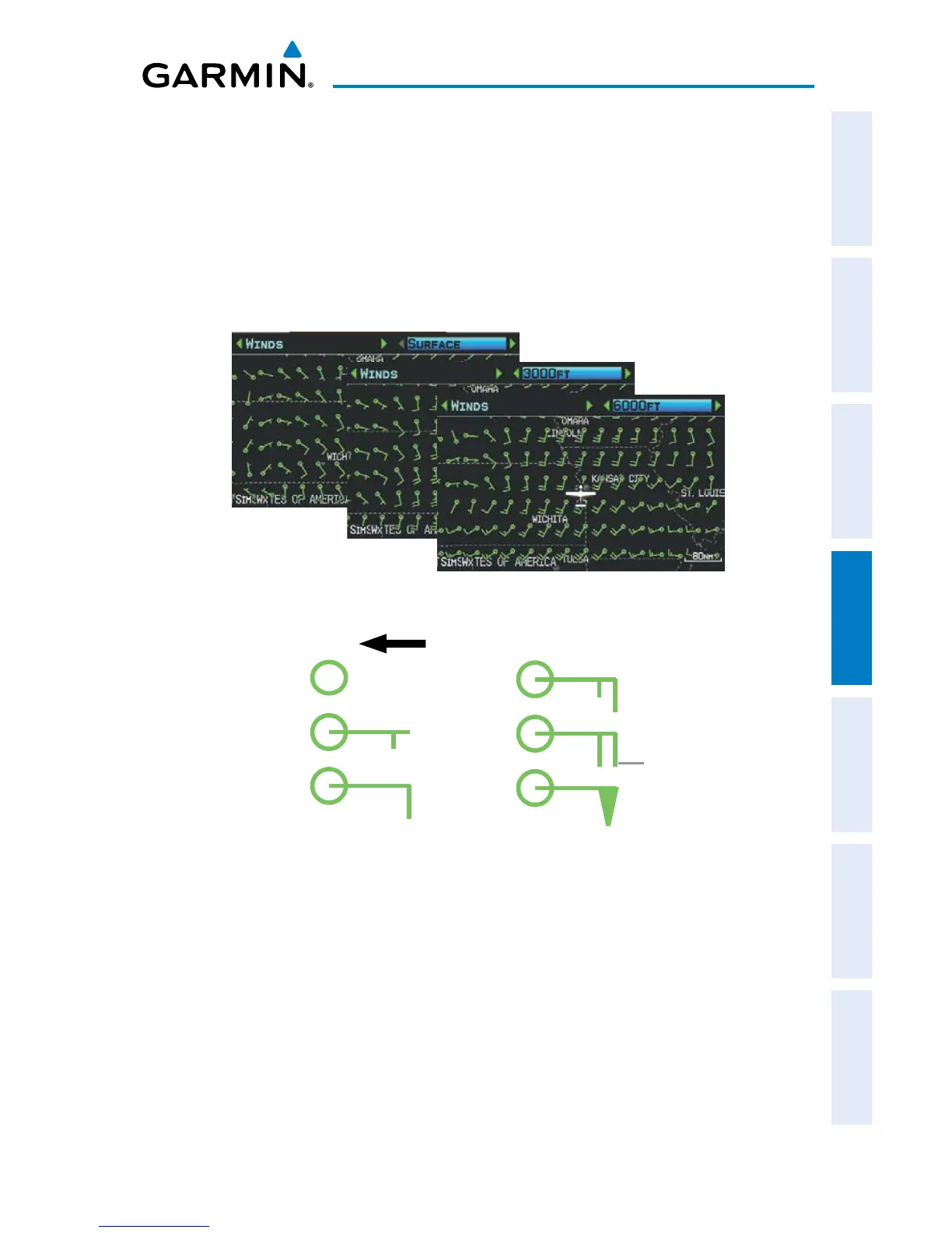
WINDS ALOFT
Winds Aloft data shows the forecasted wind speed and direction in 3,000-foot
increments up to 39,000 feet MSL.
The wind barbs always point in the direction that the wind is coming from. The wind
speed is depicted using flags at the end of the wind barb. A short wind flag is 5 knots,
a long wind flag is 10 knots, and a triangle flag is 50 knots.
Winds Aloft Data (Split-Screen)
Winds Barbs
Wind Direction
Calm
5 Knots
10 Knots
15 Knots
20 Knots
50 Knots
Wind Flag
TEMPERATURES ALOFT
Temperature Aloft data shows the forecasted temperatures aloft in 3,000-foot
increments up to 39,000 feet MSL. For altitudes 18,000 feet and above the relative
ISA temperature is also shown. Temperatures are color coded with temperatures near
and below freezing are shown as shades of blue, green for temperatures just above
freezing and shades of orange are used for warmer temperatures.