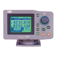
GPS Navigator J-NAV500
8
Definition of Terms
GPS satellite GPS stands for “Global Positioning System.” One of several
satellites launched by the US Department of Defense to estab-
lish a military navigational aid system.
DGPS The process of correcting the inaccuracies of GPS position data
from GPS satellites by receiving a beacon receiver (via a bea-
con station) in a base station whose exact position is known.
Position fixing The process of deriving the current location of a vessel using
GPS or DGPS receiver.
2D (two-dimensional) Position fixing using satellites and height information.
3D (three-dimensional) Position fixing using satellites information only from four or
more satellites
HDOP Indicates the accuracy of position fixing. The smaller the num-
ber shows the more accurate the position fixing.
When the satellites are grouped together, HDOP increases and
position fixing accuracy is poor; when the satellites are far apart,
HDOP decreases and position fixing accuracy is enhanced.
Loran C time difference Information for deriving current position by calculating the time
difference between a master station and secondary station of the
Loran C system. (Information designed for users experienced
in the use of the Loran C navigation system)
TD Time difference. The time difference between a master station
and secondary station of the Loran C system.
Route plan A plan that registers a series of waypoints in a navigational path.
CDI Course Deviation Indicator. Information that indicates the ex-
tent you have strayed from the route of deviation and the direc-
tion to steer.
Arrival alarm An alarm indicating that the vessel has come within the set dis-
tance of a waypoint.
Anchor alarm An alarm indicating that the vessel has deviated more than the
set distance from a waypoint.
Off-course alarm An alarm indicating that the vessel has deviated more than a set
distance from a predetermined course.

 Loading...