Press ESC to exit the app.
7.6 Remote Elevation
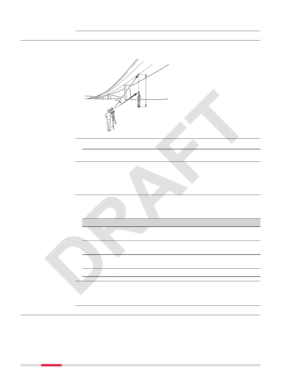
Remote Elevation is an app used to compute points directly above the base
prism without a prism at the target point.
P0 Instrument station
P1 Base point
P2 Remote point
d1 Slope distance
a Height difference from P1 to
P2
a
Vertical angle between base
point and remote point
1. Select Apps from the Main Menu.
2. Select Remote Elevation.
Measure to the base point.
Next step
After measuring, the results screen appears.
Aim the instrument at the inaccessible remote point.
Description of elds
Field Option Description
Ht: Display only Calculated difference in height between the
base point and the remote point.
Hd : Display only Horizontal distance between station point
and target point.
V : Display only Vertical angle to the measured point or cal-
culated offset point.
Hz: Display only Horizontal angle to the measured point.
•
Either, press OK to save the measurement and record the calculated
coordinates of the remote point.
•
Or, press Stop to measure the base point again.
7.7 Area
Area is an app used to compute online areas to a maximum of 50 points
connected by straights. The target points have to be measured, selected from
memory, or entered via the keypad in a clockwise direction. The calculated
area is projected onto the horizontal plane (2D).
Next step
Description
Access
Remote height
measurement
Results
Next step
Description
58 Apps


 To Next Page