15
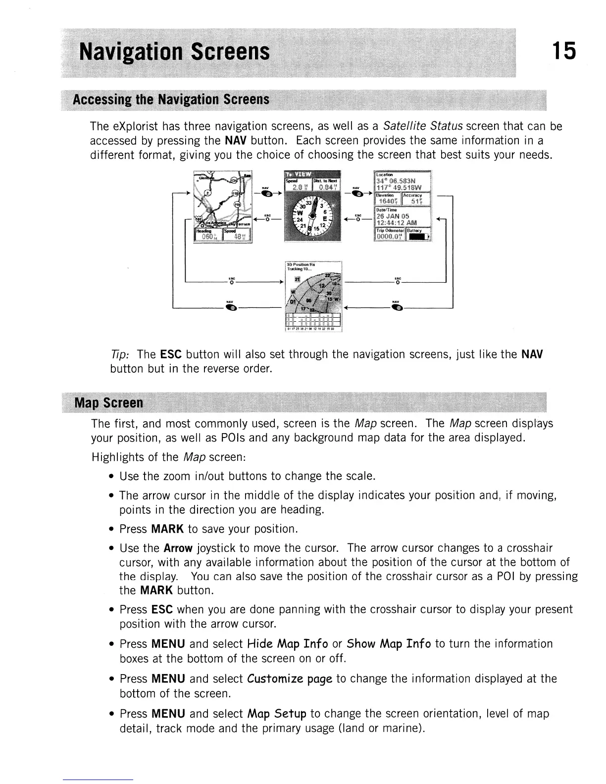
The
eXplorist
has
three navigation screens,
as
well
as
a
Satellite
Status
screen
that
can
be
accessed
by
pressing the
NAV
button.
Each
screen
provides the
same
information
in
a
different format, giving
you
the choice of choosing the
screen
that
best
suits
your
needs.
'----0-----.
NAV
L--
.---
NAV
+-----.---~
Tip:
The
ESC
button will
also
set
through the navigation screens, just like the
NAV
button but
in
the
reverse
order.
The
first,
and
most commonly
used,
screen
is
the Map screen.
The
Map
screen
displ-ays
your position,
as
well
as
POls
and
any
background
map
data for the
area
displayed.
Highlights of the
Map screen:
•
Use
the
zoom
in/out buttons to change the scale.
•
The
arrow
cursor
in
the middle of the display indicates your position
and,
if moving,
points
in
the direction
you
are
heading.
•
Press
MARK to
save
your
position.
•
Use
the Arrow joystick to
move
the
cursor.
The
arrow
cursor
changes
to a crosshair
cursor, with
any
available information about the position of the cursor
at
the bottom of
the display.
You
can
also
save
the position of the crosshair cursor
as
a
POI
by
pressing
the MARK button.
•
Press
ESC
when
you
are
done
panning with the crosshair cursor
to
display your present
position with the arrow cursor.
•
Press
MENU
and
select Hide
Map
Info
or
Show
Map
Info to turn the information
boxes
at
the bottom of the
screen
on
or
off.
•
Press
MENU
and
select Customize page to change the information displayed
at
the
bottom of the screen.
•
Press
MENU
and
select
Map
Setup to change the
screen
orientation,
level
of
map
detail, track
mode
and
the primary
usage
(land
or
marine).