$'03#HART3OUNDER#%-+
))
Power supply 10-32 V dc
Power drain 10/7 W
Dimensions 144x252x70mm/1.5kg
Environm. 0°C to +50°C, waterproof
Display, b&w6-inch, 320x240 pixels
STN transflective
- color 5.5-inch, 320x240 pixels
TFT, power backlight
Interfacing 2 ports in/out NMEA 0180,
0182, 0183,dual station, IS11
Alarm/log Output for relay
'03SECTION
Receiver 8-channel parallel, C/A
code, all-in-view
Filter 8-state Kalman filter
Accuracy: DGPS= 2-5m RMS
GPS= Position: 8m RMS*
- 15m - 95% of fixes
- Speed: 0.1 kn*
- Heading: 1°*
Speed filter 10 settings
Update 1-2 sec’s interval, typical
Dynamics Velocity: 600 km/h
Acceleration: 10m/s
2
WP/marks 999 w/info (12 characters)
Tracks 9 tracks, 256 points/each +
selectable interval
Lines Approx.500 lines/line sections
Routes 30 w/max.99 WPs/each
'03!NTENNA23
Type Quadrifilar Helix
Dimensions L: 230mm, D: 38mm/150 gr
$'03!NTENNA-',
Type GPS (patch) & diff.(H-field)
Dimensions H:75mm, D:127mm/600gr
Environm. -35°C to +75°C, 95% rel.
Mounting 1" 14 thread (standard US).
Cable Max. 10m RG58 (standard)
Max. 30m RG213 (option)
%CHOSOUNDERSECTION
Frequency 50/200 kHz, selectable
Output power Low:15 W, High: 500 W
RMS (4,000 w PP)
Depth range
display 5-1000 units and auto
Depth range Up to 350m at 200kHz, and
800m at 50kHz
Max. ping rate 6 pings per second
Alarms Fish, max. and min. depth
Zoom Bottom and VRM expan-
sion: 3 to 50 units
Event marker At current ping
Image speed True distance/time,
1 step/ping and freeze
Temperature Transducer or NMEA
Speed (water) Transducer or NMEA
/PTIONS
C-MAP electronic charts CF95
6-channel NMEA Buffer RS5345
Sunhood
*The accuracy is measured on a satellite constellation with HDOP <8 and without SA. US Department of De-
fence has intentionally degraded the accuracy for civil users to <100m in 95% of the position fixes.
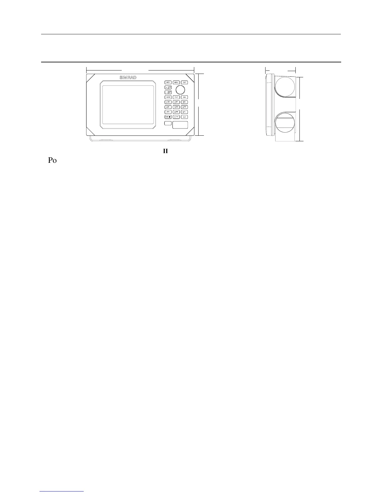
3PECIFICATIONSOFTHE#%-+))
252 mm
144 mm
70 mm
157 mm
#%-+)))NSTALLATIONANDSERVICE #HAPTER
103