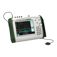
7-3 Coverage Mapping LTE and TD-LTE Coverage Mapping
7-2 PN: 10580-00234 Rev. T 3GPP MG
Outdoor Coverage
With a valid GPS signal, the instrument identifies the current location on the displayed
GeoEmbedded map with a plus sign. Previously saved locations display as colored squares.
Using GPS, latitude, longitude, and altitude data is automatically saved for each location.
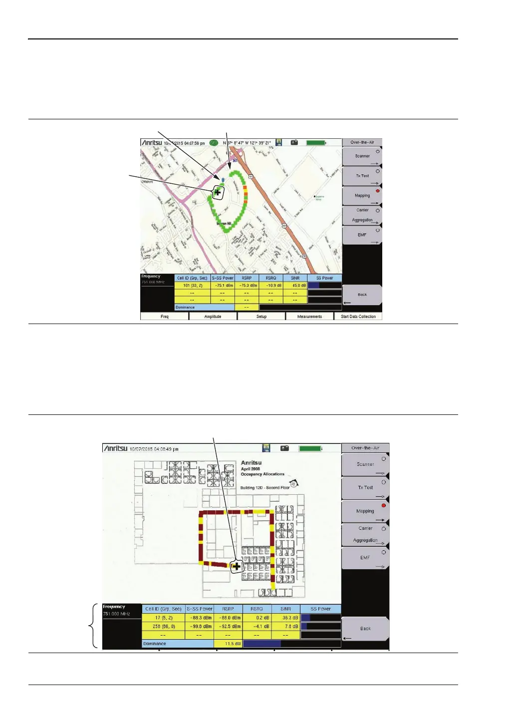
Indoor Coverage
With GPS turned off and a non-GeoEmbedded map file, the user indicates the current
position (+) with the touchscreen. On instruments that do not have a touchscreen, use the
arrow keys. Previously saved locations are displayed as colored squares.
Figure 7-1. Outdoor Coverage Mapping (GPS On)
Figure 7-2. Indoor Coverage Mapping (GPS Off)
Start Data Collection
Current Location
Stop Data Collection
Current Location
Set with Touchscreen or Arrow Keys
Measurement
Setup
ООО "Техэнком" Контрольно-измерительные приборы и оборудование www.tehencom.com
 Loading...