CHAPTER 4 REFERENCE GUIDE
EFD1000 PRO MAX PFD Pilot’s Guide
Page 4-45
091-00005-002 ()
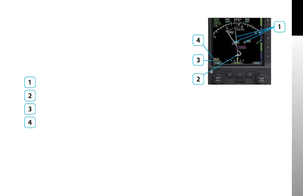
4.7 Navigational Map
The Navigational Map provides for the depiction of Flight Plan, Basemap data,, Weather
and Traffic information on the Navigation Display, providing situational awareness of
these elements in context of the aircraft location, heading and track on the Navigation
Display . If Evolution Synthetic Vision is enabled, the Nav Map can also show terrain,
obstacles, landmarks. The map is always oriented with magnetic heading up and
centered so that the current aircraft position coincides with the aircraft’s Ownship
Symbol. The current declutter level and range are shown on the lower left side of the
display (Figure 4-89).
Basemap Symbols
Aircraft Ownship Symbol
Declutter Level
Range
Figure 4-89
Basemap (ARC CDI Compass Mode Shown)