787 Flight Crew Operations Manual
DO NOT USE FOR FLIGHT
Flight Management, Navigation -
Flight Management System
Operation
Copyright © The Boeing Company. See title page for details.
11.31.16 D615Z003-TBC
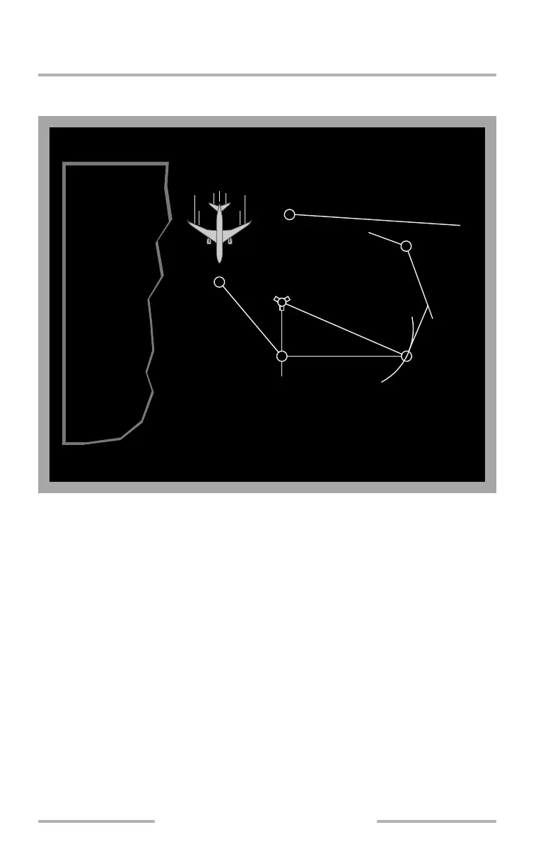
Altitude and course intercept conditional waypoints display on the CDU inside
(parenthesis) marks. The diagram below shows conditional waypoints.
Manually Entered Latitude/ Longitude Waypoints
Pilot defined waypoints entered as a latitude and longitude display in a
seven–character format. Latitude and longitude waypoints are entered with no
space or slash between the latitude and longitude entries. Leading zeroes must be
entered. All digits and decimal points (to 1/10 minute) must be entered unless the
latitude or longitude are full degrees. Examples:
• N47° W008° is entered as N47W008 and displays as N47W008
• N47° 15.4’ W008° 3.4’ is entered as N4715.4W00803.4 and displays as
N47W008
Manually Entered Place Bearing/Distance or
Place Bearing/Place Bearing Waypoints
Waypoints entered as a place bearing/distance or place bearing/place bearing are
identified by the first three characters of the entry followed by a two–digit
sequence number. Examples:
• SEA330/10 becomes SEA01
• SEA330/OLM020 becomes SEA02
ABC20
MEANING:
340
o
to BCD
to INTC
020
o
HDG
to CDE
090
o
R
VECTORS
280
o
for
090
o
HDG to 20 DME
140
o
HDG
to 180
o
R
CDE
BCD
ABC
ABC180
to 1000'
180
o
HDG
EXAMPLE:
ICTN()
001()0
CBA20
CBA108
SGEL1ETR
o
08GDH1
41
o
0GDH
90
o
0GDH
20
o
0GDH
430
o
28
o
0
72
o
0
EDC
SROTCEV
DCB
Note: All waypoints except BCD and CDE are examples of conditional waypoints.
August 14, 2009