3.8 DISPLAY NAVIGATION INFORMATION (NEW INFORMATION DISPLAY)
3ņ88
3
y
y y
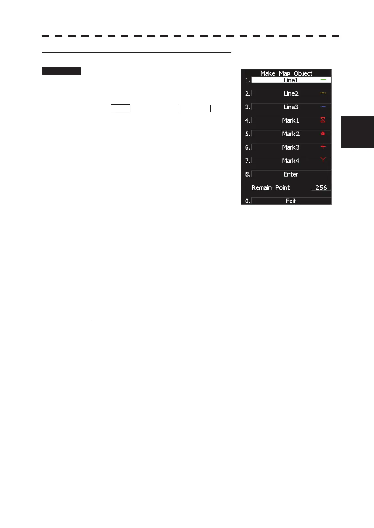
2 Making navigation information (Make Map Object)
Procedure 1 Press [2] key while the Edit User MAP
Menu is open.
The Make Map Object Menu will appear.
MAKE will appear in the CURSOR mode
field at software button ղ located at the bottom
right corner of the radar display described in
Section 2.3.3.
2 Select the type of navigation
information to be made, pressing the
corresponding numeric key.
3 Use the trackball to move the cross
cursor mark to the starting point of a
line or a point where a mark is to be
made, and press [ENT] key.
The starting point of a line or one point of a mark will be determined.
4 Repeat step 3, and press [8] key when finishing the making of the line or
mark.
The line or mark make mode will terminate.
5 To make another line or mark, repeat steps 2 to 4.
6 Press [0] key when finishing the making of all navigation information.
The Edit User Map Menu will reappear.
Note: Navigation information can be created with a maximum of 256 points being plotted.
The number of points that can still be plotted (REMAIN POINT in the menu) is decremented
each time a line or mark is plotted.
 Loading...