ņ21
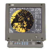
11.19 PERFORMANCE MONITOR (NJU-85)
(1) Dimensions Height 130mmuWidth 149mmuDepth 70mm
(2) Mass Approx. 1.2kg
(3) Operating frequency 9410 ±30MHz
11.20 INPUT ENABLE SIGNAL
(1) Navigation equipment: IEC61162-1/2
Receive port NAV1/NAV2/GPS port
Receive capability sentence.
Longitude/Latitude: GGA>RMC>RMA>GNS/GLL
Waypoint: RMB>BWC(BWR)
COG/SOG: RMC>RMA>VTG
SPEED: VBW
Day/Time information: ZDA
Alarm acknowledge: ACK
Rate of Turn : ROT
Rudder : RSA
(2) Bearing signal: GYRO-SYNC: 360X, 180X, 90X, 30X. (Require optional NSK
unit NCT-4106A)
GYRO-STEP: 360X, 180X, 90X, 30X. (Require optional NSK
unit NCT-4106A)
JRC-NSK format (JLR-10, JLR20/30)
IEC61162-2 38400bps: THS>HDT>HDG>HDM>VHW
(over 40Hz)
IEC61162-1: THS>HDT>HDG>HDM>VHW
Can’t be use for target tracking.
(3) Speed signal: LOG-SYNC: 360X, 180X,90X, 30X. (Require optional NSK
unit NCT-4106A)
LOG-PULSE: 800, 400, 200, 100. (Require optional NSK unit
NCT-4106A)
(4) External event mark: Contact input by way of terminal board.
(5) Depth: DPT>DBK>DBT>DBS, JRC format
(6) Water temperature: MTW, JRC format
(7) Tendency: CUR, JRC format
(8) Direction of wind, velocity of wind: MWV, MWD
(9) AIS: IEC61162-2
VDM, VDO (Require optional AIS process unit NQA-2155)
Note: The Speed measuring accuracy of speed sensor shall confirm to IMO Resolution MSC.96(72).
The measuring accuracy of GPS shall confirm to IMO Resolution MSC.112(73).
 Loading...