C-MAP cartridges marked with ’P&T’ have a built-in
0ORT4IDEINFORMATION system. The Tide system cal-
culates and displays the tidal situation for a selected
tide station for 24 hours.
On the C-MAP charts there will be a tide symbol
indicating the location of the tide stations. However,
the T-symbol is not visible in all chart scales. Please
see below for how to access the 4IDEINFORMATION.
From chart display:
3ELECTACHARTSCALEWHERETHE4SYMBOLSAREVISIBLE
- they are typically seen in the scales associated with
the ’direct access’ keys 3, 4 or 5.
0LACETHECURSORONTHE4SYMBOLFORTHE4IDESTATION
YOUWISHTORECEIVEINFORMATIONFROMANDPRESS [ENT]
An info window will first appear with information on
the object, and after a few seconds the 4IDEINFORMATION
will be presented. Example:
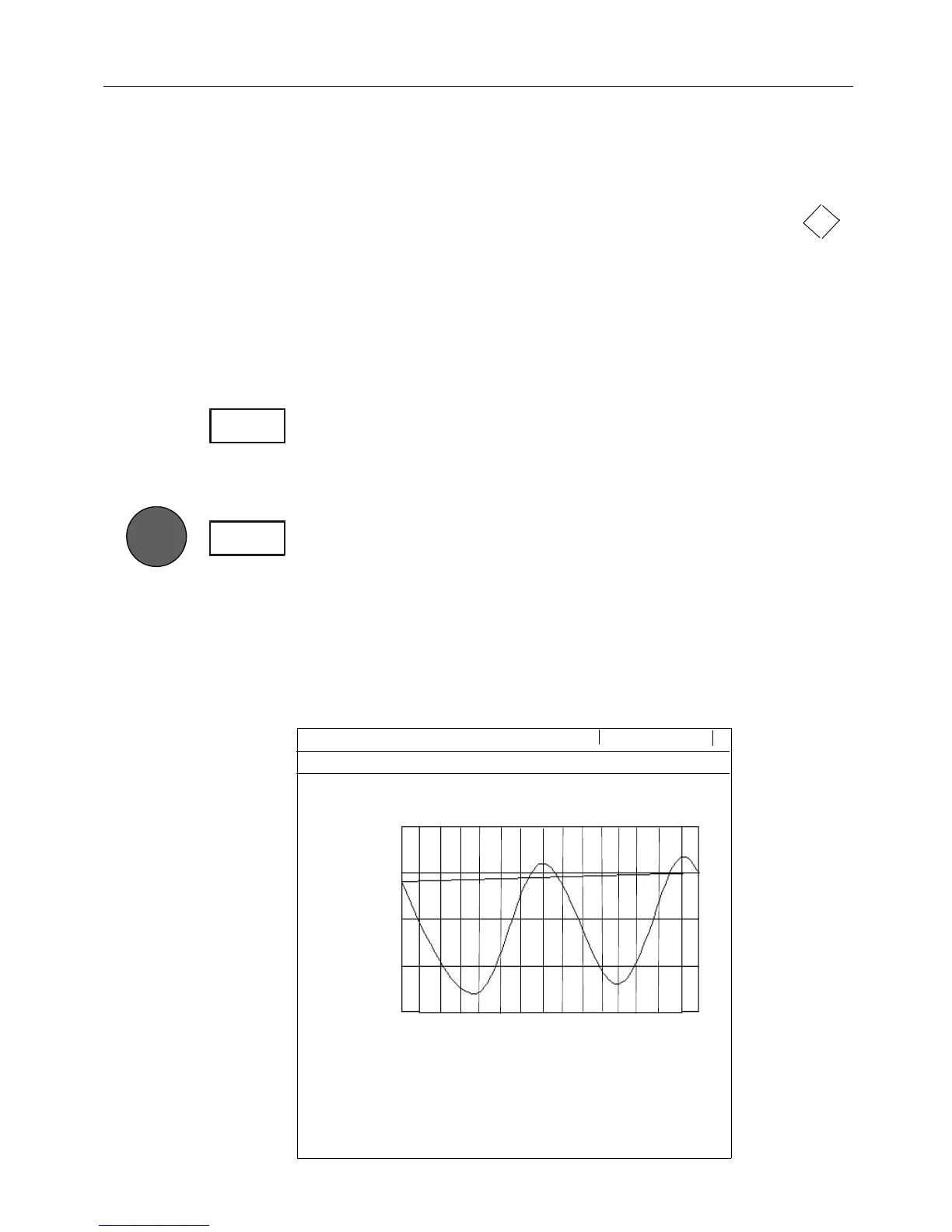
Scale 1:60000 ← 0.93nm →
Tide height
Object name: MINA AL AHMADI
Time zone: -3
2.9m
2.4m
1.9m
1.4m
1.0m
16 20 24 04 08 12
DATE: 22-02-1999 UTC Time: 14:36
High Water (max) 2.6m 23:30
Low Water (min) 1.1m 17:00
Sunrise: 5:27-06:18 Sunset: 17:42-18:33
4
3-5
ENT
#%-+))#-!00ORTANDTIDEINFORMATION !PPENDIX$
119