#ALLUPGRAPHICALSTEERINGDISPLAY
(navigation must be active)
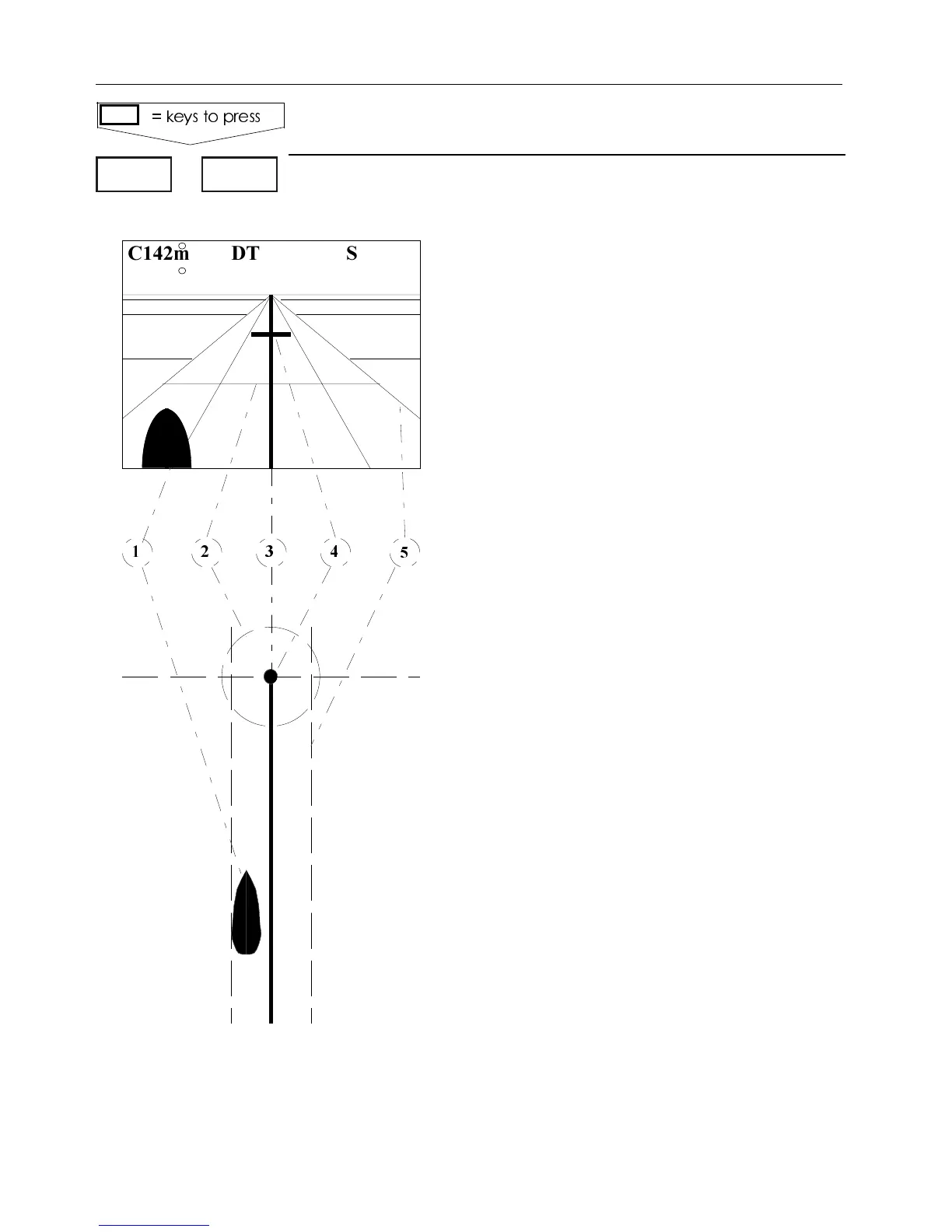
C: Course over ground
DT: Depth (external)
S: Speed over ground
B: Bearing to approaching waypoint
WP: Approaching waypoint
V: Speed towards waypoint - "velocity"
X: XTE - Cross-track-error
D: Distance to waypoint
8a: Satellite status indicator
Bottom line in display indicates WP
no., route no., 4ime 4o 'o for Way-
point navigation or 4otal $istance To
'o for Route navigation and "earing
to .ext WP.
1. Ship’s position in relation to intended
track. (Does not indicate heading).
2. Waypoint circle alarm -you will re-
ceive an alarm when touching the circle
3. Ideal course line between two way-
points starting from ship’s position
when NAV is activated.
4. Waypoint and waypoint line - you
will receive an alarm when reaching
the point/line.
5. XTE alarm lines - you will receive
an alarm if you drift so far off the cour-
seline and touch one of the boundary
lines.
.AVIGATIONDISPLAY
KEYSTOPRESS
#M$43
"M706
8
Status
8a
$
7044'
F Adjust alarm limits in 3%450.
MENU 4,1
#HAPTER #%-+))7AYPOINTSANDNAVIGATION
34