CE33 C-MAP attributes Appendix C-1
The optional detailed C-MAP NT+ cards can provide numerous of functions
which are accessible via symbols presented on the electronic chart. Place the
cursor on a C-MAP object e.g. a buoy or light to call up a small data window
with details on the object. The data window will stay on screen for about 10
seconds or till cursor is moved. For expanded information, place the cursor on
a C-MAP object and press [ENT] to call up an info window:
Scale: 1:20000 Actual chart scale
No user data
at cursor position
1
Edit user data
Inactive function
2
Chart info
See details below
3
Find nearest port services
See details below
4
Bearing and dist from A to B
See sec. 3.3 Info windows
9
Chart setup
See sec. 3.4
0
Cursor to center
See sec. 3.3 Info windows
PAGE
More user data
Inactive function
MENU
Exit
Exit info window
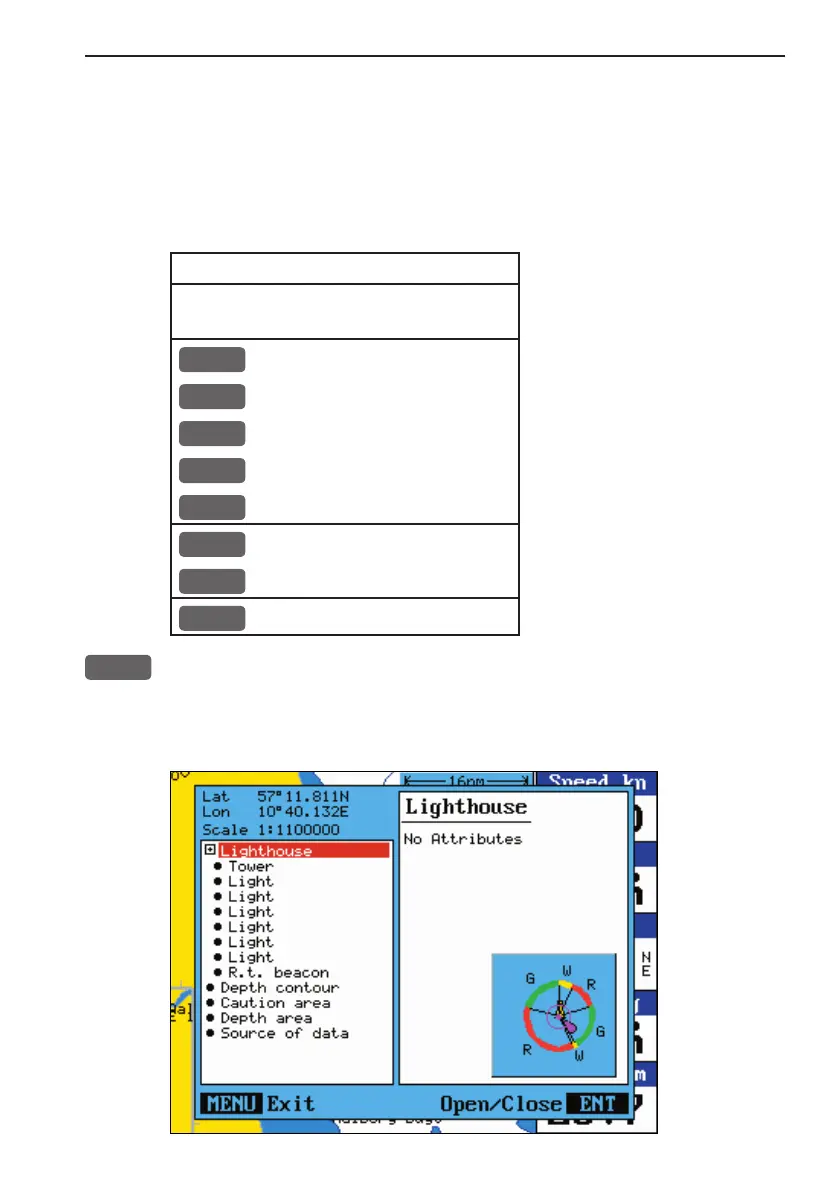
2
Chart info will provide information on the C-MAP objects e.g.
Lighthouse, Depth area, Fishery zone, Navigation mark, Buoy, Fog
signal, etc.
More details
on next
page.