Chapter 6-4 CE33 Pilot menu & navigation examples
6.2.1 Highway display
MENU
Call up the menu bar, and...
4,1
load Highway display
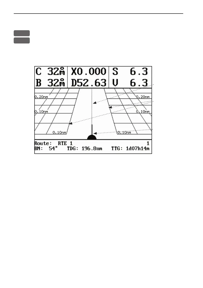
With navigation mode active, the highway display will provide a
graphical steering display:
Intended
track
between two
waypoints.
XTE alarm
lines - refer
to sec.6.1 for
alarm setup.
Ship’s posi-
tion and
heading in
relation to
intended
track.
C: Course over ground
X: XTE - Cross-track-error
S: Speed over ground
B: Bearing to approaching point
D: Distance to approaching point
V: Speed towards point
Route: Name/number of active route and aproaching routepoint
BN: Bearing to next point
TDG: Total distance to go to end of route
TTG: Total time to go to end of route