CE33 Chart menu and INFO windows Chapter 3-15
3.3.9 PLOT function
The CE33 is designed to make navigation easy and safe. Waypoints
can be inserted as numbers via the keypad. However, making routes,
drawing lines and plotting waypoints etc. are all done directly on the
chart. Very straightforward, uncomplicated and with a high level of
confidence as you can follow your actions ‘live’ on the chart.
The PLOT function is available from various displays as indicated
below.
PLOT
With any other display than chart in active page, press [PLOT] to
insert ship’s / cursor’s position as waypoint
PLOT
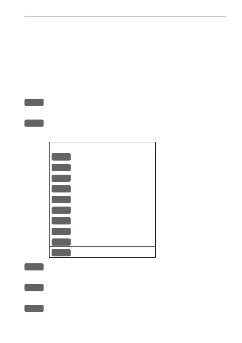
With chart in active page, press [PLOT] to call up an INFO window
with the following to choose from - text in red are inactive functions:
PLOT new data
PLOT
Plot eventmark - ship
1
Plot waypoint - cursor
2
Insert waypoint - ship
3
Insert waypoint - cursor
4
Plot waypoint from echogram
5
Make route
6
Draw line
7
Plot target - cursor
8
Set vertical mark
MENU
Exit
PLOT
From any display: Plot and save ship’s position as a waypoint, includ-
ing actual depth indication.
1
From active chart display with cursor on: Plot and save cursor posi-
tion as a waypoint.
2
From active chart display with cursor off: Plot and save ship’s
position as a waypoint, including actual depth indication; insert a
location name (cf.section 2.6), adjust the position by keying in new