Surveying with the GMS-2 (Using GMS Tools)
P/N 7010-0752
3-5
To correct this, make sure the PIN, Authentication, and
Encryption check boxes on the My Bluetooth Device screen
correspond with the security settings of the remote device.
For more information about troubleshooting error messages, see
“Bluetooth Problems” on page 6-6.
For more information about connecting devices and using
Bluetooth Manager, see “Using the Bluetooth Manager” on
page 5-1.
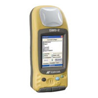
Surveying with the GMS-2
(Using GMS Tools)
The GMS-2 can be used in many surveying situations. From GIS
surveying to data collection on a construction jobsite, the GMS-2
provides an integrated solution for all your needs.
Simple surveying (data collection) with the GMS-2 can be handled
with the on-board GMS Tools software. Other surveys may require an
external GPS antenna and/or a Beacon receiver to acquire GPS
signals or correction data for better position accuracy.
Surveying with the GMS-2
For more information on GMS Tools, see “GMS Tools” on page 4-1.
1. Complete any required pre-survey steps as described in
Chapter 2.
2. Open GMS Tools, and tap the GNSS tab.
3. Check the antenna, interval, and mask settings. For typical
surveys, the antenna should be Internal.
4. Tap Logging.
5. Enter a file name in which to log data, and tap OK to begin
saving position information.
GMS-2_OM_Book.book Page 5 Friday, December 28, 2007 1:47 PM