GMS Tools
P/N 7010-0752
4-5
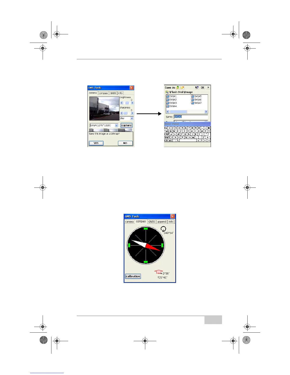
By default, captured images are saved using the ID of the capture
size (SXGA, VGA, etc.) and an incrementing number.
Figure 4-2. Take and Save a Picture
Using the Compass
The Compass tab displays the current direction, roll, and pitch of the
GMS-2. This tab also calibrates the compass.
• Pointer – North (red portion of pointer) and South (white portion
of pointer) directions.
• Angle – the angle (azimuth) from North, in degrees.
• Tilt – the roll and pitch, from level, in degrees minutes.
Figure 4-3. View the Compass
The compass may need to be calibrated if you notice that its
precision is no longer accurate.
GMS-2_OM_Book.book Page 5 Friday, December 28, 2007 1:47 PM