GMS Tools
P/N 7010-0752
4-7
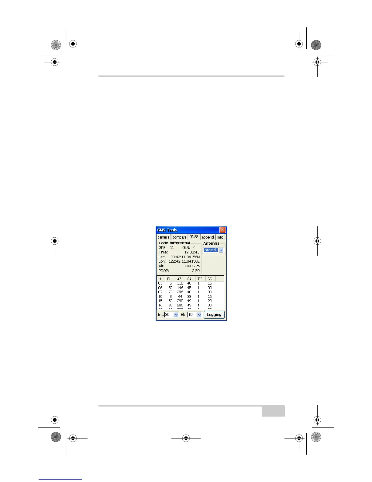
Viewing GNSS Information and Logging Data
The GNSS tab displays current position and satellite information, as
well as applies certain settings to the internal GPS receiver.
• Position information pane – displays the observation mode (No
Solution, Autonomous, or Code Differential), the number of
satellites being tracked, current time, current position (Lat/Lon/
Alt), and current PDOP.
• Antenna – selects the type of GPS antenna used, either the
internal GMS-2 antenna or an external antenna.
• Interval – the time interval for recording data. For example,
selecting 10 will record a position every 10 minutes.
• Elevation – the elevation mask for recording data from satellites
above the selected elevation (angle). For example, selecting 10
will have GMS Tools only record data from satellites that are 10°
above the horizon.
Figure 4-6. View GNSS Information
To log data, tap Logging on the GNSS tab of GMS Tools. Enter a
name for the file in which to log data and tap OK to begin saving
position information.
GMS-2_OM_Book.book Page 7 Friday, December 28, 2007 1:47 PM