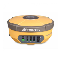
Principles of Operation
P/N 7010-1004
1-7
Other differential positioning methods and systems also exist,
including, maritime radio beacons, commercial geostationary
satellites (as with the OmniSTAR service) and satellite based
augmentation systems (WAAS, EGNOS, MSAS). For use of these
other systems additional hardware and/or subscription fees may be
required that are separate from the GR-5 system.
The Real-time Kinematic (RTK) method is the most common method
of precision real-time surveying. RTK operation requires at least two
receivers collecting simultaneous GNSS data and a reliable low-
latency communication link between the receivers. As with DGPS
described earlier, one of the receivers is usually at a known location
(Base) and the other is at an unknown location (Rover). The Base
receiver collects precise carrier phase measurements, generates RTK
corrections and transmits this data to the Rover receiver. The Rover
processes this transmitted data with its own carrier phase
observations to compute its relative position with high accuracy, thus
achieving an RTK accuracy of up to 10mm horizontal and 15mm
vertical.
The GR-5 supports three widely used network RTK implementation
techniques, specifically, VRS, FKP, and MAC.
• Virtual reference station (VRS). The network software collects
raw data measurements from several reference stations that
belong to a network. These data are then estimated and processed
to produce ionospheric and tropospheric corrections for each
station and each satellite. After the rover receiver transmits its
approximate position to the network software using an NMEA
GGA message, the corrections are interpolated to the position of
the rover. Interpolated corrections are used to reconstruct the
measurements of pseudo range and carrier phase of a virtual
reference station located close to the rover. The reconstructed
measurements are transmitted to the rover as RTCM or CMR
messages.
• Area correction parameters (FKP). Unlike the VRS approach,
the network software calculates coefficients for modeling
ionospheric, tropospheric, and orbital effects for each satellite
over a specific network area. The coefficients are then transmitted
to the rover as RTCM message type 15, so that the rover can