Do you have a question about the Topcon Pocket-3D and is the answer not in the manual?
Provides a step-by-step guide for installing the Pocket-3D software.
Monitors GPS receiver status, fix, satellites, and position data.
Details methods for setting up instrument occupy and backsight stations.
Adding, editing, importing, and exporting jobsite control points.
Performing inverse, distance, polyline, surface, and object calculations.
Performing topographic surveys and stake-out using GPS.
Guiding users through stake-out tasks for points, alignments, and slopes.
Performing surveys and stake-out using a total station instrument.
Operating the system for robotic total station measurements and tracking.
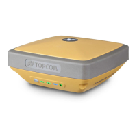
| Type | GNSS Receiver |
|---|---|
| Vertical Accuracy (RTK) | 15 mm + 1 ppm |
| Vertical Accuracy (Static) | 5 mm + 0.5 ppm |
| Storage Temperature | -30°C to +70°C |
| Waterproof/Dustproof | IP67 |
| Signal Tracking | GPS, GLONASS, QZSS, SBAS |
| Communication Interfaces | Bluetooth, USB |
| Operating Temperature | -20°C to +55°C |