SonTek RS5 User Manual (August 2020) 123
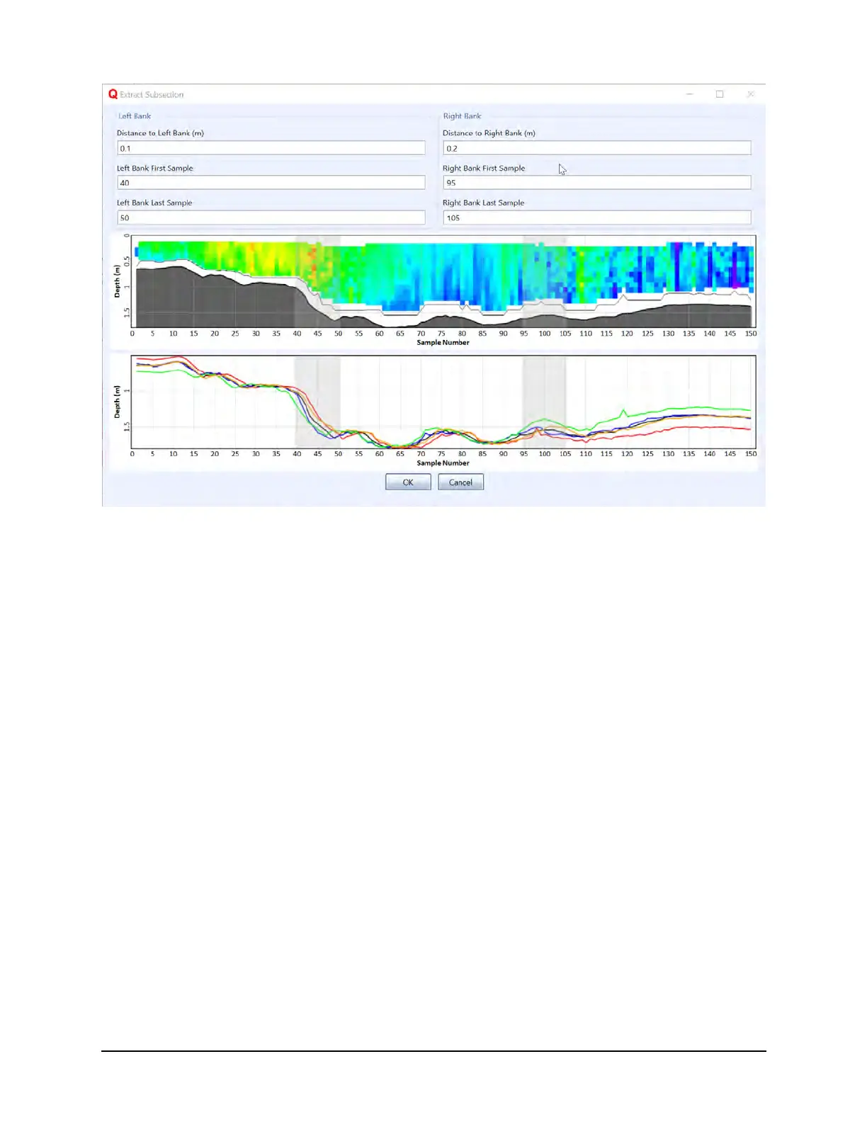
Figure 114. Extract Subsection Example
8.12. Data Processing Suggestions and Tips
This section outlines steps suggested by experienced field Hydrologists for processing
data files. The following contains suggestions only, and each measurement will require
steps specific to that site, setup, and data collection. Please use these steps as a guide
only.
1. Review the System Settings. Be sure that the settings are consistent among
transects and if not, they differ for a known reason.
2. If necessary, change the Track and Depth reference to best represent the
highest quality field measurement.
3. Select the Navigation or Transect tab to evaluate the collected data across the
channel.
4. Use the Sidebar tabular data or Samples tab to evaluate specific settings (i.e.
Duration of the measurement, GPS Quality).
5. Visually review each measurement by clicking on each tab or by using
CTRL+Tab
6. Evaluate Bottom Track vs. GPS (if applicable) to observe any compass, GPS or
moving bed issues.
7. Make sure the magnetic declination is set appropriately for the site (the default
setting is zero).
8. Make sure that the GC-BC (angle of average GPS course since start of transect
minus ADP bottom-track course; value near 0 is desired) is less than 2 degrees
 Loading...