SonTek RS5 User Manual (August 2020) 78
3. GGA
GPGGA (GGA) refers to a specific NMEA-0183 protocol for outputting GPS position
data. In this case, the GGA “string” contains actual position (latitude/longitude) along
with several other GPS parameters. Boat velocity is calculated by measuring the
distance between two successive GGA positions divided by the travel time between
those two positions. Differential corrections are required for the GGA data to reduce the
amount of position error associated with each measurement. The RS5 currently uses
one type of differential correction: sub-meter “differential” or “DGPS” corrections with its
standard Max options. “Real-Time Kinematic” (RTK) capability for the RS5 will produce
coordinates with survey-grade (c. +/- 1 to 10 cm) precision – this option will be coming
soon, but can also be achieved using an external GPS system capable of RTK
corrections.
GGA is susceptible to incorrect position data due to multi-pathing when near tree-cover
or bridges.
4. VTG
GPVTG (VTG – Velocity Traveled over Ground) refers to a specific NMEA-0183
protocol for outputting GPS velocity data. In this case, the VTG string contains the
actual boat speed information along with several other GPS parameters. The GPS
velocity is calculated based on the Doppler shift of the received satellite signals. This
method requires additional review of data quality parameters to verity data quality.
VTG is not susceptible to the multi-pathing that GGA experiences, but it does normally
require a minimum boat speed in order to obtain a reliable signal.
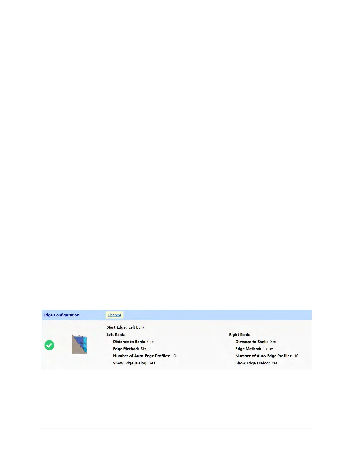
7.6. Edge Configuration
Edge Settings can be entered by clicking Change in Edge Settings section on the
Smart Page (Figure 55). Default settings are pre-populated for transects to begin on the
left bank, but this setting can be changed before starting data collection.
Figure 55. Edge Configuration
Edge configuration settings are also entered at the beginning and end of each transect
(if selected) and can be changed in post-processing. The RSQ software will alternate
starting banks on subsequent transects based on the starting edge selected for the first
transect, but this can also be changed during the transect.
 Loading...